


권호기사보기
| 기사명 | 저자명 | 페이지 | 원문 | 기사목차 |
|---|
| 대표형(전거형, Authority) | 생물정보 | 이형(異形, Variant) | 소속 | 직위 | 직업 | 활동분야 | 주기 | 서지 | |
|---|---|---|---|---|---|---|---|---|---|
| 연구/단체명을 입력해주세요. | |||||||||
|
|
|
|
|
|
* 주제를 선택하시면 검색 상세로 이동합니다.
목차
[표제지 등]=0,1,2
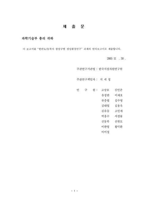
제출문=1,3,1
보고서 초록=2,4,1
요약문=3,5,10
Summary=13,15,12
Contents=25,27,1
목차=26,28,1
Figure List=27,29,8
Table List=35,37,2
제1장 연구개발과제의 개요=37,39,2
제2장 국내외 기술개발 현황=39,41,2
제3장 연구개발 내용 및 결과=41,43,1
제1절 서론=41,43,2
제2절 동북아시아의 지체구조와 광화작용=43,45,66
제3절 일본=109,111,33
제4절 몽골=142,144,49
제5절 중국=191,193,95
제6절 극동러시아=286,288,54
제7절 한반도=340,342,56
제8절 동북아시아 국가의 금속광상 목록=396,398,1
제9절 결론=397,399,12
제4장 목표달성도 및 관련분야에의 기여도=409,411,3
제5장 연구개발결과의 활용계획=412,414,1
제6장 연구개발과정에서 수집한 해외과학기술정보=413,415,2
제7장 참고문헌=415,417,19
Fig. 2-1. Altaid Orogenic Collage And Adjacent Structures (Yakubchuk, 2004)=44,46,1
Fig. 2-2. Simplified Map Showing A Possible Configuration For Rodinia. Rift Lines And Arrows Show The Way In Which Rodinia Might Have Started To Break Apart, From About 750 Ma Onwards (From Hoffman, 1991)=45,47,1
Fig. 2-3. Tectonic Model For The Paleozoic Evolution Of China And Its Neighboring Regions=47,49,1
Fig. 2-4. Tectonic Model For The Late Paleozoic-Early Mesozoic Evolution Of China And Its Neighboring Regions=48,50,1
Fig. 2-5. Tectonic Model For The Mesozoic Evolution Of China And Its Neighboring Regions=49,51,1
Fig. 2-6. Tectonic Model For The Late Cretaceous-Early Miocene Evolution Of China And Its Neighboring Regions=50,52,1
Fig. 2-7. First-Order Tectonic Units Of Asia. Cratons And Their Slivers Represent Continental Crust Formed Prior To 1000 Ma. Phanerozoic Orogens Of The Altaids, Tethysides, And Circum-Pacific Belts Are Separated By Older Crustal Blocks(From Yakubchuk et al., 2001)=51,53,1
Fig. 2-8. Map Showing A Passible Configuration For Plates At Late Cambrian (514 Ma). The Supercontinent Of Gondwana Had Just Formed And Was Located Near The South Pole=53,55,1
Fig. 2-9. Map Showing A Passible Configuration For Plates At Early Ordovician (480 Ma). During The Ordovician Ancient Oceans Separated The Barren Continents Of Laurentia, Baltica, Siberia, And Gondwana. The End Of The Ordovician Was One Of The Coldest Times In Earth History(Yakubchuk, 2002)=53,55,1
Fig. 2-10. Map Showing A Passible Configuration For Plates At Late Carboniferous (306 Ma). By The Late Carboniferous The Continents That Make Up Modern North America And Europe Had Collided With The Southern Continents Of Gondwana To Form The Western Half Of Pangea=54,56,1
Fig. 2-11. Map Showing A Passible Configuration For Plates At Early Triassic (237 Ma). The Supercontinent Of Pangea, Mostly Assembled By The Triassic, Allowed Land Animals To Migrate From The South Pole To The North Pole. Life Began To Rediversify After The Great Permo-Triassic Extinction And Warm-Water Faunas Spread Across Tethys=55,57,1
Fig. 2-12. Neotectonic Map Of Asia, Showing Most Of The Major Active Structures Of The Continent (From Sengor And Natalin, 1996)=56,58,1
Fig. 2-13. Tectonic Sketch Of Asia Showing Major Blocks And Silvers Of Precambrian Crust And Major Paleozoic Magmatic Arcs In The Altaids=59,61,1
Fig. 2-14. Generalized Tectonic Map Of The Kazakhstan-Tien Shan Sector Of The Altaids (a) And The Manchurides And Related Surrounding Units (b). (a) 1: Valerianov-Chatkal Unit, 2: Turgay Unit, 3: Baykonur-Talas Unit, 4.1: Djezkazgan-Kirgiz Unit, 4.2: Jalair-Naiman Unit, 4.3 Or 16: Borotala Un:It, 5: Sarysu Unit, 6: Atasu-Mointy Unit, 7: Tengiz Unit, 8: Kalmyk Kol-KoKchetav Unit, 9: Ishim-Stepnyak Unit, 10: Ishkeolmes Unit, 11: Selety Unit, 12: Akcdym Unit, 13: Boshchekul-Tarbagatay Unit, 14: Tekturmas Unit, 15: Junggar-Ballkash Unit, 17: Tar-Muromtsev Unit, 18: Zharma-Saur Unit. (b) 1: Ondor Sum Region, 2: Xar Moron Region, 3: Kalaid Qi Region, 4: Songhuajiang Region, Ml: Liuyuan Unit, M2: Hanshan Unit, M3: Bayan Obo-Linxi Unit, M4: Jiamusi Unit, M5: Malokhingan Unit, M6: Turan Unit (From Sengor And Natalin, 1996)(이미지 참조)=60,62,1
Fig. 2-15. Tectonic Of The Baikalide-Altaid Orogenic Collage And Adjacent Cra.Tons. Semi-Arrows Show Direction Of Strike-Slip Displacement Of Major Blocks. Magmatic Arcs.' A, Kipchak Arc (Al, Kokchetav-North Tien Shan Segment A2, Bozshakol-Chingiz Segment; A3, Salair-Kuznetsk Alatau Segment); B, Tuva-Mongol Arc (Bl, Tuva Segment; B2, Bureya Segment); C, Kazakh-Mongol Arc (Cl, Mid-Palaeozoic Segment; C2, Late Palaeozoic Segment); D, Mugodzhar-Rudny Altai Arc (Dl, Tagil Segment; D2, Magnitogorsk Segment; D3, Rudny Altai Segment); E, Valerianov-Beltau-Kurama Arc', F, Qilian Arc.,' G, Transbailkalian Arc,' H, Hingan Arc. Backarc Rifts And Backarc Basin Sutures.' L. Bailonur-Karatau Backarc Rift; 2, Khanty01VIansi Backarc Suture (2a, South Tien Shan Segment; 2b, East Urals Segment; 2c, Irtysh-Zaissan Segment); 3, Sakmara Backarc Suture. MOSZ, Mongol-Okhotsk Suture Zone(From Yakubchuk, 2002)=62,64,1
Fig. 2-16. Pre-1.0 Ga Cratons, 0.6 Cia Orogens And Their Fragments In Thc; Altaid Orogenic Collage(From Y�kubchuk, 2004)=64,66,1
Fig. 2-17. Medial Ordovician Paleotectonic Reconstruction Of The Altaids (458 Ma) (From Sengor And Natalin, 1996)=67,69,1
Fig. 2-18. Early Carboniferous Paleo-Tectonic Reconstruction Of The Altaids (342 Ma) (From Sengor And Natalin, 1996)=68,70,1
Fig. 2-19. Late Permian Paleotectonic Reconstruction Of The Altaids And The Manchurides (250 255 Ma) (From Sengor And Natalin, 1996)=70,72,1
Fig. 2-20. Sketch Of T4e Paleozoic Crustal Evolution Of Central Kazakhstan (From Shatov et al., 1996)=72,74,1
Fig. 2-21. Mesozoic Strike-Slip Faults Have Been Superimposed Onto The Altaid Orogenic Collage. They Form A Conjugate Fault System That Was Produced In Response To The Southward Propagation Th The Siberian Craton In The Late Jurassic-Cretaceous. Northwest-Trending Dextral Strike-Slip Faults In Central Asia And Kazakhstan Reveal A Total Displacement Of Approximately 500 Km. Northeast-Trending Sinistral Strike-Slip Faults In Mongolia, Transbaikalia And Far East Display Similar Amplitude Of Displacement (From Yakubchuk, 2004)=75,77,1
Fig. 2-22. Tectonic Stages During The Crustal Evolution Of Chian (Modified From Wagn And Mo, 1995)=76,78,1
Fig. 2-23. Major Ore Deposits And Magmatic Arcs Of Central Kazakhstan, And Sample Location For Nd Isotope Data. The Central Kazakhstan Oroclinal Bend Is Reflected By The Inward Younging Of Major Magmatic Arcs Towards Lake Balkash (From Heinhorst et al., 2000)=79,81,1
Fig. 2-24. εNd(T) Versus Intrusion Age For The Phanerozoic Granitoids. Data From The Following Areas' CAOB, From Hong Et Al. (2000); Caledonides, Hercynides And Himalayans, From Patchett (1992); S- And I- Type Granites From The Lachlan Fold Belt, Australia, Frorn McCulloch And Chappell (1982)(From Ma.O et al., 2003).(이미지 참조)=80,82,1
Fig. 2-25. Plot Of εNd(T) Vs Tpwy Of Granites. CAOB And Microcontinents In The CAOB From Hong Et Al. (2000); Hercynian Granites In French From Bernard-Griffiths Et Al. (1985) And Downes Et Al. (1997); Himalayan Granites From Vidal Et Al. (1984) (From Mao et al., 2003).(이미지 참조)=81,83,1
Fig. 2-26. Tectonic Subdivison And Distribution Of Metallic Mineral Deposits Of The Central Asian Orogenic Belt. Number Of The Deposits In Fig. 2-26 Is Same As Those In Table 2-1 (From Mao et al., 2003)=82,84,1
Fig. 2-27. Lithotectonic Units And Mineralization In The Baikalide-Altaid Orogenic Collage (Yakubchuk, 2002)=91,93,1
Fig. 2-28. Neoproterozoic-Early Paleozoic Structures And Mineral Deposits Of The Altaid Orogenic Collage. The Arcs And Accretionary Complexes Of This Stage Reveal Significant Segmentation By Dextral And Sinistral Strike-Slip Faults For As Much As 400-1000km. Orogenic Gold Deposits' (1) Vasilkovskoe, Bestobe, Zholymbet, Stepnyak, (2) Jerooy, (3) Berikul, Saralinskoe, (4) Kommunarskoe, (5) Zun-Kholba,' Cu-Porphyry.' (6) Bozshakol; VMS Deposits'. (7) Maikain, Akbastau-Kusmurun, Mizek, (8) Salair Group, (9) Kyzyltashtyg, (10) Ozernoe (From Yakubchuk, 2002)=95,97,1
Fig. 2-29. Middle Paleozoic Structures And Mineral Deposits Of The Altaid Orogenic Collage. Duplication Of The Eastern Part Of The Kazakh-Mongol Arc Could Possibly Take Place In The Eastern Altaids, Whereas In The Western Part This Arc Was Only Oroclinally Bent That Could Cause Migration Of This Segment Of The Arc In The Late Paleozoic. Porphyry And Epithermal Deposits.' (1) Akbakai, (2) Samarskoe(Nurkazgan), (3) Sora, (4) Aksug, (5) Oyu Tolgoi And Tsagan Suvarga, (6) Duobaoshan, VMS Deposits (7) Urals Group, (8) Rudny Altai Group, (9) Central Kazakhstan VMS (From Yakubchuk, 2002)=96,98,1
Fig. 2-30. Late Paleozoic Structures And Mineral Deposits Of The Altaid Orogenic Collage=98,100,1
Fig. 2-31. Heterochronous Island Arcs Of Central Kazakhstan As They Are Situated In The Present-Day Tectonic Grain (Upper Part). Molybdenum And Tin Provinces Of Central And East Kazakhstan (Lower Part) (From Shatov et al., 1996)=99,101,1
Fig. 2-32. Tectonic Evolution Of The Major Chinese Precambrian Blocks And Evolution Of Gold Systems In The Variscan(From Zhou And Goldfarb, 2002)=100,102,1
Fig. 2-33. Tectonic Evolution Of The Major Chinese Precambrian Blocks And Evolution Of Gold Systems In The Indosinian(From Zhou And Goldfarb, 2002)=101,103,1
Fig. 2-34. Tectonic Evolution Of The Major Chinese Precambrian Blocks And Evolution Of Gold Systems In The Yanshanian From Zhou And Goldfarb, 2002)=103,105,1
Fig. 2-35. Distribution Of Cretaceous-Palaeogene Granitoids And Metallogenic Provinces In The Circum-Japan Sea Region. 1VIajor Faults Are (BTL) But.Suzo Tectonic Line,' (CSF) Central Sikhote-Alin Fault; (HF) Hatakawa Fault; (HTB) Hayachine Tectonic Belt? (ISTL) Itoigawa-Shizuoka Tectonic Line', (MFF) Mishan-Fushun Fault; (MTL) Median Tectonic Line? (PF) Partizan9 Fault; And (TTL) Tanakura Tectonic Line. The MTL Divides Southwest Japan Into Inner Zone And Outer Zone(From Sato, 2004)=104,106,1
Fig. 2-36. Geodynamic Evolution Of The Altaid And North Pacific Orogenic Collages. Both Orogenic Systerns Evolved Through Backarc Spreading In Several Basins And Following Collision Of Magmatic Arcs With Each Other And Adjacent Amalgamation Of Orogenic Collages Took Place Due To Clockwise Rotation Of Adjacent Cratons And Subsequent Arc-Arc And Arc-Continent Collisions With Associated Emplacement Of Orogenic Gold Deposits. Compiled Using Parfenov (1995) And Yakubchuk Et Al. (2001)=105,107,1
Fig. 3-1. Plate Tectonics Of The Japanese Arc System (Taira, 2001). (a) F'Late Tectonic Framework Of Northeastern Asia. (b) Main Part Of The Japanese Arc System, Showing The Distribution Of The Four Big Islands. (c) Plate Bound�iries Of The Japanese Arc System. Note That Central Honshu Shows Complex Microplate Tectonics Dominated By The Median Tectonic Line (MTL), Right-Lateral Motion, And Bookshelf Type Rotation Tectonics=110,112,1
Fig. 3-2. GPS Vector Data From GEONET, The GPS Network Maintanied By The Geographical Survey Institute Of Japan, Showing The Crustal Deformation Of The Japanese Arc System From Jan. 1997 To Jul. 1999 (After Sagiya et al., 2000)=114,116,1
Fig. 3-3. New Geotectonic Subdivision Of The Japanese Islands=115,117,1
Fig. 3-4. Paleogeographic Reconstruction Since 130 Ma. (After Taira et al., 1989)=120,122,1
Fig. 3-5. Division Of The Basement Rocks Of The Japanese Islands And Distribution Of Stratabound Cu And Mn Deposits After Sato And Kase (1996) And Isozaki (1997a)=123,125,1
Fig. 3-6. Distribution Of Granitoids And Related Metallic Deposits In Japan After Ishihara And Sasaki (1991)=128,130,1
Fig. 3-7. Neogene And Quaternary Tectonic Framework Of Japan Showing Gold And Copper Deposits After Garwin Et Al. (1995)=131,133,1
Fig. 3-8. Histograms Showing Frequencies Of Mineral Commodities, Deposit Types, Host Rock Ages And Mineralization Ages Of Mineral Deposits In Japan, Respectively. Abbreviations Of Mineral Commodity. Gyp Gypsum, Py' Pyrite, The Other Ones Are Same As Element Symbols=138,140,1
Fig. 3-9. Grade-Production Diagrams Of Au And Cu Deposits In Japan=139,141,1
Fig. 4-1. Distribution Of Cratons And Orogenic Belts In The Central Asia=143,145,1
Fig. 4-2. Distribution Of Cratons And Magmatic Arcs In The Central Asia=144,146,1
Fig. 4-3. Scheme Of Tectonic Subdivision Of The Territory Of Mongolia Compiled By Amantov Et Al. (Geology MPR, 1977). 1. Proterozoic Geosynclinal Complexes, 2-5, Early Caledonian Geosynclinal Complex, 2. Carbonate Rocks, 3. Marine Andesite-Dacite Volcanic Rocks, 4. Marine Volcanism, 5. Ophiolite Suture Zones, 6-7. Late Caledonian Geosynclinal Zones, 6. Volcanogeny, 7. Terrigene Rocks, 8 More Large Orogenic Overlapped Structures Formed After Caledonian Folding, 9-11. Hercynian(Middle Paleozoic) Geosynclinal Complexes, 9. Devonian Terrigene-Carbonate Rocks, 10. Marine Volcanic Rocks, 11. Terrigene Zone=145,147,1
Fig. 4-4. Tectonic Subdivision Of The Territory Of Mongolia (O. Tomurtogoo, 2001). 1. Superterrane, 2-8. Terranes' 2. Passive Continental Margin, 3. Continental Margin Arc, 4. Accretionary Wedge, 5. Island Arc, 6. Ocean, 7. Turbidite, 8. Metamorphic', 9. Mongolian Major Tectonic Lineament; TM, Tuva-Mongol Superterrane With Terranes Of: Zavhan-Orhon, 2. Hug, 3. Shishged, 4. Tas-Uul, 5. Ulaantaiga,' HE, Herlen Superterrane With Terranes Of: 6. Ereendavaa, 7. Ondurhaan, 8. Idermeg, 9. Ikhbogd-Ondorshil; Simple Terranes' AJ, Ajbogd, BH, Bayanhongor, GB, Govi-Altai Baruunurt, GO, Govi, EH, Eastern Hovsgol, ZU, Zamyn-Uud, MA, Mongol Altai, LA- Lake, SU, Sulinheer, TN, Govi Tenger-UulNuhetdavaa, HO, Hovd, HU, Hutag-Uul, HH, Hangay-Hentey, TE, Tseel, E, Eguur=146,148,1
Fig. 4-5. Terrane Subdivision Of Mogolia(Badarch et al., 2002)=147,149,1
Fig. 4-6. Distribution Map Of Passive Continental Margin Terranes In Mongolia (Bor-Ming Jahn et al., 2005)=148,150,1
Fig. 4-7. Distribution Map Of 4 Metamorphic Terranes In Mongolia, Showing The Age Of 481-474 Ma, 390-350 Ma, And The Age Of Granulite 384 Ma=149,151,1
Fig. 4-8. Distribution Of Ophiolites And Mafic-Ultramafics In Mongolia (After Zonenshain, 1977 And Badarch, 2005). Ophiolite Zones' ATC: Agardag-Tes, Hem, HH: Khan Khohii, TU: Tas-Uul, HT: Hotol, OU: Onts-Uul, HU: Halzan-Uul, HT: Hantayshir, IB: Ikh Bogd, BH: Bayanhongor, DZ: Dzida(Argyngol), SH: Shishged, DN: Dunhzugur, HE: Herlen, OS: Ondurshil, AD: Adaatsag, TN: Tolbo-Nuur, BD: Bodonch, BDZ: Bidz, BG: Bayangovi, BL: Bayanleg, NG: Nomingovi, ON: Ongon-Uul, ZO: Zoolon, GS: Gurvansaihan, MN: Manlai, SL: Sulinheer, ZA: Zaamar, HD: Nogoondavaa (Nogoondavaa, Khohtolgoi, Khartolgoi Ultramafic Protrusives)=149,151,1
Fig. 4-9. Distribution Of Island Arc, Backarc/Forearc Basin And Accretionary Wedge Terranes In Mongolia=151,153,1
Fig. 4-10. Distribution Of 6 Island Arc Terranes In Southern Mongolia=151,153,1
Fig. 4-11. Distribution Of 8 Backarc And Forearc Basin Terranes In Mongolia=152,154,1
Fig. 4-12. Distribution Of 7 Accretionary Wedge Terranes In Mongolia=152,154,1
Fig. 4-13. Major Tectonic Structures And Metallogenic Megaprovinces In Mongolia And Adjacent Areas. 1.Cratons, SB: Siberian, TR: Tarim, NC: North China, YK: Yangtze-South Korea. 2-6, Central Asian Planetary Fold Belt And Coincided Same Name Planetary Metallogenic Province. 2: Baikalid And Coincided Enisey-Pathom Metallogenic Megaprovice(EN Enisey Mountain Range, PA Pathorn Highlands), 3: TM-Tuva-Mongol Arc And Coincided Same Name Metallogenic Megaprovince, 4: Altai-Sayan Metallogenic Megeprovice(AC), 5: Kazakh Mongol Magmatic Arc(KM) And Coincided Same Name Metallogenic Megaprovince, 6: Mongol-Okhotsk Suture(MO) And Coincided Same Name Metallogenic Megaprovince, 7-8, Circum Pacific Overlapped Planetary Metallogenic Province(CP). 7: Subduction Related Internal Continental Margin Arc Zone With Dominated Volcanic(a) And With Dominated Granitoids (b), 8: Backarc Extension Related Continental Rifting Zone (Eastern Nongolia-Preargunye-Northeastern China Metallogenic Overprinted Megaprovince)=155,157,1
Fig. 4-14. Major Metallogenic Province Provinces Of Territory Of Mogolia=157,159,1
Fig. 4-15. Archean To Lower Proterozoic Cratonal And Uncertain Age Metamorphic Blocks And Related Metal Deposits. Fragments Of Archean To Lower Proterozoic Cratonal Blocks?1) Gargan (Or Hoshimgol), 2) Zunygol, 3) Tarvagatai, 4) Huenuy, 5) Songino, 6) Govi-Altai-Baidrag, 7) South Herlen, 8) Ereendavaa, 9) Hutag-Uul, 10) Sagaan-Uul=164,166,1
Fig. 4-16. Meso-Through Neoproterozoic Terranes, Overlapped Assemblages And Related Mineral Deposits. 1) Cenozoic Basalt Plateau,' 2) Mesozoic To Cenozoic Sedimentary Basin,' 3) Shishged(SH) Island Arc Terrane', 4) Hug(HG) Accretionary Wedge Terrane', 5) Continental Margin Arc Terranes'. DR) Darhad, BG) Bayangol; 6) Accretionary Wedge Terrane' UR: Urgamal; 7) Idermeg Or Dundgovi(DG) Passive Margin Terrane,' 8) Major Faults=167,169,1
Fig. 4-17. Late Neoproterozoic Through Cambrian Terranes, Overlapped Assemblages And Related Mineral Deposits. 1) Island Arc And Ophiolite Terranes', LA: Lake, EJ: Dzhid(Or Eguur-Dzhida), BH: Bayanhongor, HR: Herlen,' 2) Overlapped Carbonate Basin,' KH: Khovsgol, TO: Tsagaan-Olom,' 3) Major Faults,' 4) Mesozoic To Cenozoic Sedimentary Basin, 5) Cenozoic Basalt Plateau=169,171,1
Fig. 4-18. Cambrian Through Lower Silurian Terranes, Overlapped Assemblages Andrelated Mineral Deposits. 1) Cenozoic Basalt Plateau', 2) Mesozoic To Cenozoic Sedimentary Basins, 3) Major Deep Seated Faults,' 4) Back/Intra-Arc Basin Terranes', Al: Altai, HR Araa, ZG: Zag, AT: Atasbogd, ND: Nuhetdavaa,' 5) Accretionary Wedge Terranes'. HO: Hovd, TR: Turgen', 6) Collision Related Ordovician To Silurian Granitoids,' 7) Overlapped Upper Paleozoic Volcanic Rocks, 8) Overlapped Upper Paleozoic To Early Mesozoic Sedimentary Rocks. 9) Volcanogenic Massive Sulfide' Zn.' Zinc And Lead; 10) Volcanogene-Sedimentary' Cupper, Lead And Zinc,' Ll) Granitoid Related Mesothermal Quartz-Carbonate Vein Aii: 1P) Skarn'. C;Unoer. Fe=171,173,1
Fig. 4-19. Outcrop Of Devono-Carboniferous Volcanic Rocks In Mandalovoo Island Arc Terranes In Southeastern Mongolia=173,175,1
Fig. 4-20. Late Carboniferous Through Early Triassic Terranes, Overlapped Assemblages And Related Mineral Deposits=176,178,1
Fig. 4-21. Distribution Of Mesozoic Through Cenozoic Magmatic And Sedirnentary Rocks. 1) -5) Basins With Dominated On The Surface, 1) Neogene To Quaternary Sedimentary Rocks,' 2) Quaternary Basalt Plateau, 3) Paleogene Sedimentary Rocks, 4) Upper Cretaceous Sedimentary Rocks, 5) Lower Cretaceous Sedimentary Ocks, 6) Upper Jurassic To Early Cretaceous Basalt Dominated Volcanics, 7) Upper Jurassic Granitoids, 8Middle To Upper Jurassic Volcanic Rocks, 9) Jurassic Sedirnentary Basins, 10) Upper Triassic To Early Jurassic Rare Metals-Bearing Granite, 11) Upper Triassic To Early Jurassic High Alkaline Granite,12) Pper Triassic To Early Jurassic Andesite Dominated Volcanics, 13) Middle To Upper Triassic Sedimentary Molass', 14) Major Faults, 15) Pre-Mersozoic Structures=177,179,1
Fig. 4-22. Late Triassic Through Early Jurassic Overlapped Assemblages And Related Mineral Deposits. 1) Cenozoic Basalt Plateau, 2) Mesozoic To Cenozoic Sedimentary Basins, 3) Major Fault Zones, 4) Early Mesozoic Rare Metals-Bearing Granitoids, 5) Early Mesozoic High Alkaline Granitoids, 6) Late Triassic To Early Jurassic Andesite Dominated Volcanics, 7) Middle To Upper Triassic Continental Molasse, 8) Triassic Marine Sediments, 9) Permian Marine Sediments. DZ: Dzhid(Au, Cu), OS: Orhon-Selenge(Cu, Mo), MN: North Hentey(Au), C:HA: Central Hangay(W, Sn, Mo), EH: Eastern Hangay(Au), DH: Delgerhaan(Cu, Au), CHE: Central Hentey(W, Sn), SH: South Hentey (Au), EMPA: Ea:;Tern Mongolia-Preargunye, ND: Nukhetdavaa, HHL: Har Morit-Hanbogd-Lugii.Ngol (REE, W, Sn, Ta, Nb, Zr)=178,180,1
Fig. 4-23. Tectonics Around Mongolia During Late Jurassic-Early Cretaceous, Showing Extensional Basins And Compressional Basins(Lamb And Badarch (1997)=179,181,1
Fig. 4-24. Gold And Sil Ver Deposits And Occurrences Of Mongolia (MRAM, Geoinformation Center, 2003)=182,184,1
Fig. 4-25. Cu Deposits And Occurrences Of Mongolia (MRAM, Geoinformation Center, 2003)=184,186,1
Fig. 4-26. Metallogenic Belts With Copper Deposits And Occurrences Of Mongolia (MRAM, Geoinformation Center, 2003)=184,186,1
Fig. 4-27. Base Metal'S (Pb, Zn, Ni, Co, Al) Deposits And Occurrences Of Mongolia (MRAM, Geoinformation Center, 2003)=185,187,1
Fig. 4-28. Rare Metal'S (REE) Deposits And Occurrences Of Mongolia (M:RAM, Geoinformation Center, 2003)=186,188,1
Fig. 4-29. Rare Metal'S (As, Sb, Hg, Sr, REE, Y) Deposits And Occurrences Of Mongolia (MRAM, Geoinformation Center, 2003)=186,188,1
Fig. 4-3O. Fluorite Deposits And Occurrences Of Mongolia (MRAM, Geoinformation Center, 2003)=187,189,1
Fig. 5-1. Tectonic Division Of China=193,195,1
Fig. 5-2. Tectonic Division Of Western Tianshan-Xingmeng Terrane. 6: Altai Fold Belt, 7: Zhunger Fold Belt, 7-1: Western Zhunger Eugeosynclinal Fold Belt, 7-2: Eastern Zhunger Eugeosynclinal Fold Belt, 7-3: Zhunger Depression, 8: Tianshan Fold Belt, 8-1: Northern Tianshan Eugeosynclinal Fold Belt, 8-2: Tianshan Central Rise, 8-3: Southern Tianshan Miogeosynclinal Fold Belt, 8-4: Beishan Eugeosynclinal Fold Belt, 8-5: Tulufan Hami Intermontane Depression, 8-6: Yili Intermontane Depression, 8-7: Wulumuqi Piedmont Depression=194,196,1
Fig. 5-3. Tectonic Division Of Sino-Korean Craton. 1. Alashan Anteclise, 2. Marginal Fold Belt Of Ordos Terrain 3. Ordos Synclise 4. Inner Mongolia Craton. 5. Shanxi Fault Uplift, 6. Yanshan Anteclise, 7. Huabei Fault Depression, 8. JiaoLiao Anteclise, 9. Luxi Fault Uplift, 10. Yuxi Anteclise=196,198,1
Fig. 5-4. The Sketch Map Of LVIiddle To Upper Proterozoic Rift System Of Sino-Korean Craton. L. Uplift Region, 2. Oceanic Crust Area, 3. Volcanic Rocks Of Xiong'Er Group, 4. Volcanic Rocks Of Kuanping Group And Lower Part Of Feziling Group, 5. Oceanic And Arc Island Volcanic Rock Assemblage, 6. Rift, 7. Subduction Belt, 8. Shear Belt=197,199,1
Fig. 5-5. The Sketch Map Of Middle To Upper Proterozoic Rift Systern In YanLiao Region, Sino-Korean Craton 1: Tours Of Deposit Thickness(Km), 2. Fault, 3. Paleocontinental Uplift, 4. Submarine Volcanic-Sedimentary Rocks=198,200,1
Fig. 5-6. Tectonic Division Of Qinling-Qilian-Kunlun Terrane (Eastern Portion). 11 Qilian Fold Belt, 11-1: Corridor Transitional Zone(Miogeosynclinal Fold Belt), 11-2: Northern Qilian Eugeosynclinal Folding Zone, 11-3: Qilian Central Rise,' 11-4: Southern Qilian Folding Zone, 12: Qinling Fold Belt, 12-1: Southern Qinling Miogeosynclinal Fold Belt, 12-2: Lixian Zhashui Miogeosynclinal Fold Belt, 12-3: Northern Daba Fold Belt, 12-4: Northern Qiling Fold Belt, 12-5: Wudang Huaiyang Rise=201,203,1
Fig. 5-7. Qinling-Qilian-Kunlun Metallogenic Province(Eastern Portion). 13: Eastern Kunlun Fold Belt, 13-1: Aljin Eugeosynclinal Fold Belt, 13-2 Qimantage Eugeosynclinal Fold Belt, 13-3: Eastern Kunlun Central Rise, 13-4: Buerhanbuda Eugeosynclinal Fold Belt, 13-5: Oulongbuerke Rise, 13-6: Northern Chaidamu Margin Eugeosynclinal Fold Belt, 13-7: Dakendaban Fold Belt, 13-8: Chaidamu Depression, 14: Westexn Kunlun Fold Belt, 14-1: Northern Kunlun Miogeosynclinal Fold Belt, 14-2: Western Kunlun Central Rise, 14-3: Southern Kunlun Fold Belt=202,204,1
Fig. 5-8. The Sketch Map Of Tectonic Division Of Yangtz (Yangzi) Craton L. Yanyuan-Lijiang Fold Belt; 2. Longmen-Dabashan Fold Belt; 3.Sichuan Synclise', 4. Kang Dian Craton 5.Upper Yangtz (Shangyangzi) Fold Belt; 6.Jiangnan Anteclise 7. Jianghan Fault Depression, 8. Zhejiang-South Anhui (Wannan)Fold Belt 9. Lower Yangtz (Xiayangzi) Fold Belt; 10.North Jiangsu Fault Depression=204,206,1
Fig. 5-9. Tectonic Division Of South China Fold Belt L. GanXiangGuiYue Fold Belt; 2. Huaxia Fold Belt; 3.Youjiang Fold Belt; 4. Yunkai Fold Belt=206,208,1
Fig. 5-10. Tianshan-Xingmeng Metallogenic Province(Western Area). 1A: Altai Au-Pb-Zn-Cu-Ni-Fe Metallogenic Sub-Province, 2B: Junger Cr-Au-Sn-Fe-Cu Metallogenic Belt, 3: Tianshan Fe-Cu-Mn-Au-Ni Metallogenic Belt. C: Yili Au, Cu, Fe And Mn Metallogenic Belt, D: Northern Tianshan Fe-Cu-Mn-Cr-Ti-V-W Metallogenic Belt, E: Southern Tianshan Au-Fe-Mn-Pb-Zn Metallogenic Belt, F: Jueluotage Fe-Cu-Ni-Au Metallogenic Belt, G: Beishan Fe-Cu-Au-V-U-Ni-Pb-Zn Metallogenic Belt=209,211,1
Fig. 5-11. The Estern Tianshan-Xingmeng Metallogenic Province. 4: Erg Mna Cu-Mo-Ag-Au-Pb-Zn Belt. 5: Daxinganling-Dongmeng Cu-Pb-Zn-W-Sn-Mo-Au-Fe Belt, J: Daxinganling Cu-Mo-Pb-Zn-Fe-Cr Metallogenic Belt, K: East Wuqi Pb-Zn-W-Sn Belt, L: Xilinhaote Fe-Sn-W-Pb-Zn-Cu Belt, M: Duolun Cifeng Cu-Au-Pb-Zn-W Belt, 6: Xiaoxinganling-Jiamusi Pb-Zn-Fe-Au-Cu-Mo Belt, N: Xiaoxinganling-Zhangguangcailing Pb-Zn-Fe-Au-Mo-Cu Belt, 0: Jiamusi Fe-Au-W Belt, P: Siping Yanji Mo-Cu-Ni-Pb-Zn-Au-Ag Belts=212,214,1
Fig. 5-12. Division Of Metallogenic Belts Of Sino-Korean Craton=215,217,1
Fig. 5-13. The Sketch Map Of Petrography-Paleogeography And Distribution Of Ore Deposits At Langshan-Chartai Rift System. 1: Sandstone-Shale-Carbonate Formation, 2: Sandstone Formation, 3: Paleocontinent 4: Contours Of Deposit Thickness, 5: Ore Deposits=216,218,1
Fig. 5-14. Qinling-Qilian-Kunlun Metallogenic Province. 1: Northern Qinling Metallogenic Belt, 2: Southern Qinling Metallogenic Belt, 3: Qilian Metallogenic Belt, 4: Chaidamu And Its Margin Metallogenic Belt, 5: Eastern Kunlun Alken Metallogenic Belt, 6: Western Kunlun Metallogenic Belt=218,220,1
Fig. 5-15. The Sketch Map Of Division Of Metallogenetic Belts In Yangtz Craton. 1: Cu, Au, Ag, Pb, Zn(Fe) Metallogenetic Belt Of Middle-Lower Yangtz River, 2: Proterozoic And Yanshan Epoch Cu, Au, Ag, Pb, Zn Metallogenetic Belt Of West Zhejiang-South Jiangsu Region, 3: Yanshan Epoch Au, Ag, Sn, Pb, Zn(W, REE) Metallogenetic Belt Of East Part Of Jiangnan Earth�s Axis, 4: Yanshan Epoch Au, Sb,(Diamond), Ph, Zn, Ag Metallogenetic Belt Of Jiangnan Craton, 5: Upper Paleozoic Mn, Hg,(Bauxite) Metallogenetic Belt Of South Sichuan-Central Guizhou, 6: Lower Paleozoic And Yanshan Epoch Pb, Zn, Ag, Mn(Fe) Metallogenetic Belt Of Zhaotong-Liupanshui Region, 7: Proterozoic, Variscan, Yanshan And Himalayan Epoch Cu, Pb, Zn, Au, Ag(Fe, V, Ti, REE) Metallogenetic Belt At Western Margin Of Yangtz Craton=221,223,1
Fig. 5-16 The Geological Map Of Woxi Gold Deposit. 1: Red Sandstong-Conglomerate Of Upper Cretaceous Period, 2: Wuqiangxi Formation Of Banxi Group, 3: Upper Part Of Madiyi Formation Of Banxi Group, 4: Middle Part Of Madiyi Formation Of Banxi Group, 5: Lower Part Of Madiyi Formation Of Banxi Group, 6:Engjiaxi Group, 7: Ore Vein=223,225,1
Fig. 5-17. Metallogenetic Belts Division Of Huanan Fold System(South China Fold Belt)=226,228,1
Fig. 5-18 The Sketch Map Of The Unconformity Between Upper And Lower Permian System In Qinzhou Uplift 1. Silicious Shale, 2. Gravel=229,231,1
Fig. 5-19. The Metallogenetic Model Of Gold Deposits In Qianxinan (Southwestern Guizhou Province). 1: Bianyang Formation, 2: Niluo Formation, 3: Xuman Formation, 4: Luolou Formation, 5: Ziyun Formation, 6: Calcirudyte, 7-9: Yelang Formation, 10: Reef Carbonate, 11: Wujingping Formation, 12: Linggu Formation, 13: Basalts Of Emeishan, 14: Dachang Formation, 15: Moukou Formation, 16: Qixia Formation, 17: Sidaxiu Formation, 18: Basalt, 19: Variation Line Of Petrography, 20: Major Fault, 21: Fault, 22: Au-Sb Ore Body, 23: Residual And Collapsed Gold Ore Body, 24: Direction Of Meteoric Water Adding, 25: Hydrothermal Fluid Transportation Direction=230,232,1
Fig. 5-20. Tectonic Division Of The Three River Area And Cu-Pb-Zn-Sn-Mo-Au-Ag-Ni-Co Metallogenic Belt. 16: Shanjiang Fold Belt, 16-1: Wuli Angqian Fold Belt, 16-2: Lanchangjiang Fold Belt, 16-3: Jinshajiang Eugeosynclinal Fold Belt, 16-4: Baoshan Fold Belt, 16-5: Lanping Simao Depression, 16-6: Lao�aishan Fold Belt=233,235,1
Fig. 5-21. Jiheixing'An Metalogenic Subprovince Showing Four Au Mineralized Belts From The Tianshan-Xingan Au Province=242,244,1
Fig. 5-22. Beijiang-Tianshan-Altai Metalogenic Subprovince Showing 4 Au Mineralized Belts From The Tianshan-Xingan Au Province=244,246,1
Fig. 5-23. Distribution Of Au Deposits In The Eastern Kunlun-Qilian Au Belt=249,251,1
Fig. 5-24. Distribution Of Au Deposits In The Yangtz Continental Au Area=250,252,1
Fig. 5-25. Distribution Of Au Deposits In The Nanhua Au Metallogenic Belt=251,253,1
Fig. 5-26. Distribution Of Au Deposits In Songpan-Ganzi Au Mineralized Belt=253,255,1
Fig. 5-27. The Distribution Of Sn Deposits In South China=259,261,1
Fig. 5-28. The Distribution Of Sn Deposits In Northeast China=259,261,1
Fig. 5-29. Distribution Of Sb Deposits In China=264,266,1
Fig. 5-30. Distribution Of Major Hg Deposits In China=266,268,1
Fig. 5-31. Distribution Of REE Deposits In China=269,271,1
Fig. 5-32. Distribution Of Ag Deposits In China=273,275,1
Fig. 5-33. Distribution Of Fe Deposits In China=275,277,1
Fig. 5-34. Distribution Of Mo Deposits In China=277,279,1
Fig. 5-35. Distribution Of Cu Deposits In China=279,281,1
Fig. 5-36. Distribution Of W Deposits In China=281,283,1
Fig. 5-37. Distribution Of Pb-Zn Deposits In China=283,285,1
Fig. 6-1. The Rnap Of Metallogenic Provinces Of The Russia Far East=288,290,1
Fig. 6-2. The Map Of Aldano-Stanovoy Rnetallogenic Province Of The Russia Far East=290,292,1
Fig. 6-3. The Map Of Amur Metallogenic Province From The Russin Far East=295,297,1
Fig. 6-4. The Map Of Verkoyano-Chukotsky Metallogenic Province From The Russin Far East=315,317,1
Fig. 6-5. The Map Of Okhotsko-Chukotsky Metallogenic Province From The Russin Far East=317,319,1
Fig. 6-6. The Map Of (Khokkaido)-Sakhalin Metallogenic Province From The Russin Far East=330,332,1
Fig. 6-7. The Map Of Kurilo-Kamchatsko-Koryaksaky Metallogenic Province From The Russin Far East=333,335,1
Fig. 7-1. Tectonic Division Of Korea Peninsular=343,345,1
Fig. 7-2. Early Ordovicion Terranes Of Korea Peninsula=344,346,1
Fig. 7-3. Schematic Movement Of The Izanagi Plate From Middle Jurassic To Late Cretaceous=345,347,1
Fig. 7-4. The Opening Mode In The East Asia ' (a) Pre-Opening Stage, (b) Back-Arc Spreading With Crustal Thining And Extensive Volcanic Eruption, (c) Rotation Of The Japanese Islands By Pivoting Of The Pholippine Sea Plate(Y. S. Lee, Et. Al., 1999)=346,348,1
Fig. 7-5. Map Of The Metallogenic Provinces/Mineral Belts, South Korea. (1-1-1-4) Hongcheon-Cheonan-Youngdong-Seolcheon And Hapcheon Au-Ag Metallogenic Province. (2) Siheung-Gapeong Pb-Zn Metallogenic Province. (3) Hwanggangri Au-(Pb-Zn, Cu) Metallogenic Province. (4) Geumsan-Muju F-Pb-Zn Metallogenic Province. (5) Hongcheon-Yangyang-Seosan Fe-Pb-Zn Metallogenic Province, (6) Taebaegsan Metallogenic Province. (7) Haman-Gunbug-Goseong Cu Metallogenic Province. (8) Euiseong Au-Cu Metallogenic Province=362,364,1
Fig. 7-6. Detailed Map Of The Metallogenic Provinces/Belts In The Western Korea. (1-2) Cheonan Au-Ag Metallogenic Belt; (2) Siheung-Gapeong Pb-Zn Rnetallogenic Provinces', (3) Hwanggangri Au-(Pb-Zn, Cu) Metallogenic Province,' (4) Geumsan-Muju F-Pb-Zn Metallogenic Province', (5) Seosan Fe Mineral Belt=363,365,1
Fig. 7-7. Detailed Map Of The Metallogenic Provinces/Rnineral Belts In The Eastern Korea. (1-1 & 3) Hongcheon % Youngdong-Seolcheon Au-Ag Mineral Beltse', (5) Yangyang-Hongcheon Fe-Pb-Zn Belts', (6) Taebaegsan Metallogenic Province', (7) Goseong Cu Belt; (8) Euiseong Au-Cu Metallogenic Province=364,366,1
Fig. 7-8. Detailed Map Of The Metallogenic Provinces/Mineral Belts In The Southern Korea. (1-3, 4) Youngdong-Seolcheon 8z Hapcheon Au-Ag Mineral Belt; (4) Geumsan-Muju F-Pb-Zn Metallogenic Province,' (7-2) Haman-Gunbug Cu Mineral Belts=365,367,1
Fig. 7-9. Distribution Of Metallogenic Provinces In The Gyeongsang Basin=379,381,1
jpg
Fig. 2-7. First-Order Tectonic Units Of Asia. Cratons And Their Slivers Represent Continental Crust Formed Prior To 1000 Ma. Phanerozoic Orogens Of The Altaids, Tethysides, And Circum-Pacific Belts Are Separated By Older Crustal Blocks(From Yakubchuk et al., 2001)=51,53,1
Fig. 2-8. Map Showing A Passible Configuration For Plates At Late Cambrian (514 Ma). The Supercontinent Of Gondwana Had Just Formed And Was Located Near The South Pole=53,55,1
Fig. 2-9. Map Showing A Passible Configuration For Plates At Early Ordovician (480 Ma). During The Ordovician Ancient Oceans Separated The Barren Continents Of Laurentia, Baltica, Siberia, And Gondwana. The End Of The Ordovician Was One Of The Coldest Times In Earth History(Yakubchuk, 2002)=53,55,1
Fig. 2-10. Map Showing A Passible Configuration For Plates At Late Carboniferous (306 Ma). By The Late Carboniferous The Continents That Make Up Modern North America And Europe Had Collided With The Southern Continents Of Gondwana To Form The Western Half Of Pangea=54,56,1
Fig. 2-11. Map Showing A Passible Configuration For Plates At Early Triassic (237 Ma). The Supercontinent Of Pangea, Mostly Assembled By The Triassic, Allowed Land Animals To Migrate From The South Pole To The North Pole. Life Began To Rediversify After The Great Permo-Triassic Extinction And Warm-Water Faunas Spread Across Tethys=55,57,1
Fig. 2-12. Neotectonic Map Of Asia, Showing Most Of The Major Active Structures Of The Continent (From Sengor And Natalin, 1996)=56,58,1
Fig. 2-13. Tectonic Sketch Of Asia Showing Major Blocks And Silvers Of Precambrian Crust And Major Paleozoic Magmatic Arcs In The Altaids=59,61,1
Fig. 2-14. Generalized Tectonic Map Of The Kazakhstan-Tien Shan Sector Of The Altaids (a) And The Manchurides And Related Surrounding Units (b). (a) 1: Valerianov-Chatkal Unit, 2: Turgay Unit, 3: Baykonur-Talas Unit, 4.1: Djezkazgan-Kirgiz Unit, 4.2: Jalair-Naiman Unit, 4.3 Or 16: Borotala Un:It, 5: Sarysu Unit, 6: Atasu-IUIointy Unit, 7: Tengiz Unit, 8: Kalmyk Kol-KoKchetav Unit, 9: Ishim-Stepnyak Unit, 10: Ishkeolmes Unit, 11: Selety Unit, 12: Alcdym Unit, 13: Boshchekul-Tarbagatay Unit, 14: Tekturmas Unit, 15: Junggar-Ballkash Unit, 17: Tar-Muromtsev Unit, 18: Zharma-Saur Unit. (b) 1: Ondor Sum Region, 2: Xar Moron Region, 3: Kalaid Qi Region, 4: Songhuajiang Region, Ml: Liuyuan Unit, M2: Hanshan Unit, M3: Bayan Obo-Linxi Unit, M4: Jiamusi Unit, M5: Malokhingan Unit, M6: Turan Unit (From Sengor And Natalin, 1996)=60,62,1
Fig. 2-15. Tectonic Of The Baikalide-Altaid Orogenic Collage And Adjacent Cra.Tons. Semi-Arrows Show Direction Of Strike-Slip Displacement Of Major Blocks. Magmatic Arcs.' A, Kipchak Arc (Al, Kokchetav-North Tien Shan Segment A2, Bozshakol-Chingiz Segment; A3, Salair-Kuznetsk Alatau Segment); B, Tuva-Mongol Arc (Bl, Tuva Segment; B2, Bureya Segment); C, Kazakh-Mongol Arc (Cl, Mid-Palaeozoic Segment; C2, Late Palaeozoic Segment); D, Mugodzhar-Rudny Altai Arc (Dl, Tagil Segment; D2, Magnitogorsk Segment; D3, Rudny Altai Segment); E, Valerianov-Beltau-Kurama Arc', F, Qilian Arc.,' G, Transbailkalian Arc,' H, Hingan Arc. Backarc Rifts And Backarc Basin Sutures.' L. Bailonur-Karatau Backarc Rift; 2, Khanty01VIansi Backarc Suture (2a, South Tien Shan Segment; 2b, East Urals Segment; 2c, Irtysh-Zaissan Segment); 3, Sakmara Backarc Suture. MOSZ, Mongol-Okhotsk Suture Zone(From Yakubchuk, 2002)=62,64,1
Fig. 2-16. Pre-1.0 Ga Cratons, 0.6 Cia Orogens And Their Fragments In Thc; Altaid Orogenic Collage(From Y�kubchuk, 2004)=64,66,1
Fig. 2-17. Medial Ordovician Paleotectonic Reconstruction Of The Altaids (458 Ma) (From Sengor And Natalin, 1996)=67,69,1
Fig. 2-18. Early Carboniferous Paleo-Tectonic Reconstruction Of The Altaids (342 Ma) (From Sengor And Natalin, 1996)=68,70,1
Fig. 2-19. Late Permian Paleotectonic Reconstruction Of The Altaids And The Manchurides (250 255 Ma) (From Sengor And Natalin, 1996)=70,72,1
Fig. 2-20. Sketch Of T4e Paleozoic Crustal Evolution Of Central Kazakhstan (From Shatov et al., 1996)=72,74,1
Fig. 2-21. Mesozoic Strike-Slip Faults Have Been Superimposed Onto The Altaid Orogenic Collage. They Form A Conjugate Fault System That Was Produced In Response To The Southward Propagation Th The Siberian Craton In The Late Jurassic-Cretaceous. Northwest-Trending Dextral Strike-Slip Faults In Central Asia And Kazakhstan Reveal A Total Displacement Of Approximately 500 Km. Northeast-Trending Sinistral Strike-Slip Faults In Mongolia, Transbaikalia And Far East Display Similar Amplitude Of Displacement (From Yakubchuk, 2004)=75,77,1
Fig. 2-23. Major Ore Deposits And Magmatic Arcs Of Central Kazakhstan, And Sample Location For Nd Isotope Data. The Central Kazakhstan Oroclinal Bend Is Reflected By The Inward Younging Of Major Magmatic Arcs Towards Lake Balkash (From Heinhorst et al., 2000)=79,81,1
Fig. 2-25. Plot Of Ewa(T) Vs Tpwy Of Granites. CAOB And Microcontinents In The CAOB From Hong Et Al. (2000); Hercynian Granites In French From Bernard-Griffiths Et Al. (1985) And Downes Et Al. (1997); Himalayan Granites From Vidal Et Al. (1984) (From Mao et al., 2003)=81,83,1
Fig. 2-26. Tectonic Subdivison And Distribution Of Metallic Mineral Deposits Of The Central Asian Orogenic Belt. Number Of The Deposits In Fig. 2-26 Is Same As Those In Table 2-1 (From Mao et al., 2003)=82,84,1
Fig. 2-27. Lithotectonic Units And Mineralization In The Baikalide-Altaid Orogenic Collage (Yakubchuk, 2002)=91,93,1
Fig. 2-28. Neoproterozoic-Early Paleozoic Structures And Mineral Deposits Of The Altaid Orogenic Collage. The Arcs And Accretionary Complexes Of This Stage Reveal Significant Segmentation By Dextral And Sinistral Strike-Slip Faults For As Much As 400-1000km. Orogenic Gold Deposits' (1) Vasilkovskoe, Bestobe, Zholymbet, Stepnyak, (2) Jerooy, (3) Berikul, Saralinskoe, (4) Kommunarskoe, (5) Zun-Kholba,' Cu-Porphyry.' (6) Bozshakol; VMS Deposits'. (7) Maikain, Akbastau-Kusmurun, Mizek, (8) Salair Group, (9) Kyzyltashtyg, (10) Ozernoe (From Yakubchuk, 2002)=95,97,1
Fig. 2-29. Middle Paleozoic Structures And Mineral Deposits Of The Altaid Orogenic Collage. Duplication Of The Eastern Part Of The Kazakh-Mongol Arc Could Possibly Take Place In The Eastern Altaids, Whereas In The Western Part This Arc Was Only Oroclinally Bent That Could Cause Migration Of This Segment Of The Arc In The Late Paleozoic. Porphyry And Epithermal Deposits.' (1) Akbakai, (2) Samarskoe(Nurkazgan), (3) Sora, (4) Aksug, (5) Oyu Tolgoi And Tsagan Suvarga, (6) Duobaoshan, VMS Deposits (7) Urals Group, (8) Rudny Altai Group, (9) Central Kazakhstan VMS (From Yakubchuk, 2002)=96,98,1
Fig. 2-30. Late Paleozoic Structures And Mineral Deposits Of The Altaid Orogenic Collage=98,100,1
Fig. 2-36. Geodynamic Evolution Of The Altaid And North Pacific Orogenic Collages. Both Orogenic Systerns Evolved Through Backarc Spreading In Several Basins And Following Collision Of Magmatic Arcs With Each Other And Adjacent Amalgamation Of Orogenic Collages Took Place Due To Clockwise Rotation Of Adjacent Cratons And Subsequent Arc-Arc And Arc-Continent Collisions With Associated Emplacement Of Orogenic Gold Deposits. Compiled Using Parfenov (1995) And Yakubchuk Et Al. (2001)=105,107,1
Fig. 3-1. Plate Tectonics Of The Japanese Arc System (Taira, 2001). (a) F'Late Tectonic Framework Of Northeastern Asia. (b) Main Part Of The Japanese Arc System, Showing The Distribution Of The Four Big Islands. (c) Plate Bound�iries Of The Japanese Arc System. Note That Central Honshu Shows Complex Microplate Tectonics Dominated By The Median Tectonic Line (MTL), Right-Lateral Motion, And Bookshelf Type Rotation Tectonics=110,112,1
Fig. 3-2. GPS Vector Data From GEONET, The GPS Network Maintanied By The Geographical Survey Institute Of Japan, Showing The Crustal Deformation Of The Japanese Arc System From Jan. 1997 To Jul. 1999 (After Sagiya et al., 2000)=114,116,1
Fig. 3-3. New Geotectonic Subdivision Of The Japanese Islands(Isozaki, 1996; Isozaki And Maruyama, 1991). Explanatory Symbols For Geotectonic Units Used In The Figure And Text Are As Follows'=115,117,1
Fig. 3-4. Paleogeographic Reconstruction Since 130 Ma. (After Taira et al., 1989)=120,122,1
Fig. 3-5. Division Of The Basement Rocks Of The Japanese Islands And Distribution Of Stratabound Cu And Mn Deposits After Sato And Kase (1996) And Isozaki (1997a)=123,125,1
Fig. 3-6. Distribution Of Granitoids And Related Metallic Deposits In Japan After Ishihara And Sasaki (1991)=128,130,1
Fig. 3-7. Neogene And Quaternary Tectonic Framework Of Japan Showing Gold And Copper Deposits After Garwin Et Al. (1995)=131,133,1
Fig. 3-8. Histograms Showing Frequencies Of Mineral Commodities, Deposit Types, Host Rock Ages And Mineralization Ages Of Mineral Deposits In Japan, Respectively. Abbreviations Of Mineral Commodity. Gyp Gypsum, Py' Pyrite, The Other Ones Are Same As Element Symbols=138,140,1
Fig. 3-9. Grade-Production Diagrams Of Au And Cu Deposits In Japan=139,141,1
Fig. 4-1. Distribution Of Cratons And Orogenic Belts In The Central Asia=143,145,1
Fig. 4-2. Distribution Of Cratons And Magmatic Arcs In The Central Asia=144,146,1
Fig. 4-3. Scheme Of Tectonic Subdivision Of The Territory Of Mongolia Compiled By Amantov Et Al. (Geology MPR, 1977). 1. Proterozoic Geosynclinal Complexes, 2-5, Early Caledonian Geosynclinal Complex, 2. Carbonate Rocks, 3. Marine Andesite-Dacite Volcanic Rocks, 4. Marine Volcanism, 5. Ophiolite Suture Zones, 6-7. Late Caledonian Geosynclinal Zones, 6. Volcanogeny, 7. Terrigene Rocks, 8 More Large Orogenic Overlapped Structures Formed After Caledonian Folding, 9-11. Hercynian(Middle Paleozoic) Geosynclinal Complexes, 9. Devonian Terrigene-Carbonate Rocks, 10. Marine Volcanic Rocks, 11. Terrigene Zone=145,147,1
Fig. 4-4. Tectonic Subdivision Of The Territory Of Mongolia (O. Tomurtogoo, 2001). 1. Superterrane, 2-8. Terranes' 2. Passive Continental Margin, 3. Continental Margin Arc, 4. Accretionary Wedge, 5. Island Arc, 6. Ocean, 7. Turbidite, 8. Metamorphic', 9. Mongolian Major Tectonic Lineament; TM, Tuva-Mongol Superterrane With Terranes Of: Zavhan-Orhon, 2. Hug, 3. Shishged, 4. Tas-Uul, 5. Ulaantaiga,' HE, Herlen Superterrane With Terranes Of: 6. Ereendavaa, 7. Ondurhaan, 8. Idermeg, 9. Ikhbogd-Ondorshil; Simple Terranes' AJ, Ajbogd, BH, Bayanhongor, GB, Govi-Altai Baruunurt, GO, Govi, EH, Eastern Hovsgol, ZU, Zamyn-Uud, MA, Mongol Altai, LA- Lake, SU, Sulinheer, TN, Govi Tenger-UulNuhetdavaa, HO, Hovd, HU, Hutag-Uul, HH, Hangay-Hentey, TE, Tseel, E, Eguur=146,148,1
Fig. 4-5. Terrane Subdivision Of Mogolia(Badarch et al., 2002)=147,149,1
Fig. 4-6. Distribution Map Of Passive Continental Margin Terranes In Mongolia (Bor-Ming Jahn et al., 2005)=148,150,1
Fig. 4-7. Distribution Map Of 4 Metamorphic Terranes In Mongolia, Showing The Age Of 481-474 Ma, 390-350 Ma, And The Age Of Granulite 384 Ma=149,151,1
Fig. 4-8. Distribution Of Ophiolites And Mafic-Ultramafics In Mongolia (After Zonenshain, 1977 And Badarch, 2005). Ophiolite Zones' ATC: Agardag-Tes, Hem, HH: Khan Khohii, TU: Tas-Uul, HT: Hotol, OU: Onts-Uul, HU: Halzan-Uul, HT: Hantayshir, IB: Ikh Bogd, BH: Bayanhongor, DZ: Dzida(Argyngol), SH: Shishged, DN: Dunhzugur, HE: Herlen, OS: Ondurshil, AD: Adaatsag, TN: Tolbo-Nuur, BD: Bodonch, BDZ: Bidz, BG: Bayangovi, BL: Bayanleg, NG: Nomingovi, ON: Ongon-Uul, ZO: Zoolon, GS: Gurvansaihan, MN: Manlai, SL: Sulinheer, ZA: Zaamar, HD: Nogoondavaa (Nogoondavaa, Khohtolgoi, Khartolgoi Ultramafic Protrusives)=149,151,1
Fig. 4-9. Distribution Of Island Arc, Backarc/Forearc Basin And Accretionary Wedge Terranes In Mongolia=151,153,1
Fig. 4-10. Distribution Of 6 Island Arc Terranes In Southern Mongolia=151,153,1
Fig. 4-11. Distribution Of 8 Backarc And Forearc Basin Terranes In Mongolia=152,154,1
Fig. 4-12. Distribution Of 7 Accretionary Wedge Terranes In Mongolia=152,154,1
Fig. 4-13. Major Tectonic Structures And Metallogenic Megaprovinces In Mongolia And Adjacent Areas. 1.Cratons, SB: Siberian, TR: Tarim, NC: North China, YK: Yangtze-South Korea. 2-6, Central Asian Planetary Fold Belt And Coincided Same Name Planetary Metallogenic Province. 2: Baikalid And Coincided Enisey-Pathom Metallogenic Megaprovice(EN Enisey Mountain Range, PA Pathorn Highlands), 3: TM-Tuva-Mongol Arc And Coincided Same Name Metallogenic Megaprovince, 4: Altai-Sayan Metallogenic Megeprovice(AC), 5: Kazakh Mongol Magmatic Arc(KM) And Coincided Same Name Metallogenic Megaprovince, 6: Mongol-Okhotsk Suture(MO) And Coincided Same Name Metallogenic Megaprovince, 7-8, Circum Pacific Overlapped Planetary Metallogenic Province(CP). 7: Subduction Related Internal Continental Margin Arc Zone With Dominated Volcanic(a) And With Dominated Granitoids (b), 8: Backarc Extension Related Continental Rifting Zone (Eastern Nongolia-Preargunye-Northeastern China Metallogenic Overprinted Megaprovince)=155,157,1
Fig. 4-15. Archean To Lower Proterozoic Cratonal And Uncertain Age Metamorphic Blocks And Related Metal Deposits. Fragments Of Archean To Lower Proterozoic Cratonal Blocks?1) Gargan (Or Hoshimgol), 2) Zunygol, 3) Tarvagatai, 4) Huenuy, 5) Songino, 6) Govi-Altai-Baidrag, 7) South Herlen, 8) Ereendavaa, 9) Hutag-Uul, 10) Sagaan-Uul=164,166,1
Fig. 4-16. Meso-Through Neoproterozoic Terranes, Overlapped Assemblages And Related Mineral Deposits. 1) Cenozoic Basalt Plateau,' 2) Mesozoic To Cenozoic Sedimentary Basin,' 3) Shishged(SH) Island Arc Terrane', 4) Hug(HG) Accretionary Wedge Terrane', 5) Continental Margin Arc Terranes'. DR) Darhad, BG) Bayangol; 6) Accretionary Wedge Terrane' UR: Urgamal; 7) Idermeg Or Dundgovi(DG) Passive Margin Terrane,' 8) Major Faults=167,169,1
Fig. 4-17. Late Neoproterozoic Through Cambrian Terranes, Overlapped Assemblages And Related Mineral Deposits. 1) Island Arc And Ophiolite Terranes', LA: Lake, EJ: Dzhid(Or Eguur-Dzhida), BH: Bayanhongor, HR: Herlen,' 2) Overlapped Carbonate Basin,' KH: Khovsgol, TO: Tsagaan-Olom,' 3) Major Faults,' 4) Mesozoic To Cenozoic Sedimentary Basin, 5) Cenozoic Basalt Plateau=169,171,1
Fig. 4-18. Cambrian Through Lower Silurian Terranes, Overlapped Assemblages Andrelated Mineral Deposits. 1) Cenozoic Basalt Plateau', 2) Mesozoic To Cenozoic Sedimentary Basins, 3) Major Deep Seated Faults,' 4) Back/Intra-Arc Basin Terranes', Al: Altai, HR Araa, ZG: Zag, AT: Atasbogd, ND: Nuhetdavaa,' 5) Accretionary Wedge Terranes'. HO: Hovd, TR: Turgen', 6) Collision Related Ordovician To Silurian Granitoids,' 7) Overlapped Upper Paleozoic Volcanic Rocks, 8) Overlapped Upper Paleozoic To Early Mesozoic Sedimentary Rocks. 9) Volcanogenic Massive Sulfide' Zn.' Zinc And Lead; 10) Volcanogene-Sedimentary' Cupper, Lead And Zinc,' Ll) Granitoid Related Mesothermal Quartz-Carbonate Vein Aii: 1P) Skarn'. C;Unoer. Fe=171,173,1
Fig. 4-19. Outcrop Of Devono-Carboniferous Volcanic Rocks In Mandalovoo Island Arc Terranes In Southeastern Mongolia=173,175,1
Fig. 4-20. Late Carboniferous Through Early Triassic Terranes, Overlapped Assemblages And Related Mineral Deposits=176,178,1
Fig. 4-21. Distribution Of Mesozoic Through Cenozoic Magmatic And Sedirnentary Rocks. 1) -5) Basins With Dominated On The Surface, 1) Neogene To Quaternary Sedimentary Rocks,' 2) Quaternary Basalt Plateau, 3) Paleogene Sedimentary Rocks, 4) Upper Cretaceous Sedimentary Rocks, 5) Lower Cretaceous Sedimentary Ocks, 6) Upper Jurassic To Early Cretaceous Basalt Dominated Volcanics, 7) Upper Jurassic Granitoids, 8Middle To Upper Jurassic Volcanic Rocks, 9) Jurassic Sedirnentary Basins, 10) Upper Triassic To Early Jurassic Rare Metals-Bearing Granite, 11) Upper Triassic To Early Jurassic High Alkaline Granite,12) Pper Triassic To Early Jurassic Andesite Dominated Volcanics, 13) Middle To Upper Triassic Sedimentary Molass', 14) Major Faults, 15) Pre-Mersozoic Structures=177,179,1
Fig. 4-22. Late Triassic Through Early Jurassic Overlapped Assemblages And Related Mineral Deposits. 1) Cenozoic Basalt Plateau, 2) Mesozoic To Cenozoic Sedimentary Basins, 3) Major Fault Zones, 4) Early Mesozoic Rare Metals-Bearing Granitoids, 5) Early Mesozoic High Alkaline Granitoids, 6) Late Triassic To Early Jurassic Andesite Dominated Volcanics, 7) Middle To Upper Triassic Continental Molasse, 8) Triassic Marine Sediments, 9) Permian Marine Sediments. DZ: Dzhid(Au, Cu), OS: Orhon-Selenge(Cu, Mo), MN: North Hentey(Au), C:HA: Central Hangay(W, Sn, Mo), EH: Eastern Hangay(Au), DH: Delgerhaan(Cu, Au), CHE: Central Hentey(W, Sn), SH: South Hentey (Au), EMPA: Ea:;Tern Mongolia-Preargunye, ND: Nukhetdavaa, HHL: Har Morit-Hanbogd-Lugii.Ngol (REE, W, Sn, Ta, Nb, Zr)=178,180,1
Fig. 4-23. Tectonics Around Mongolia During Late Jurassic-Early Cretaceous, Showing Extensional Basins And Compressional Basins(Lamb And Badarch (1997)=179,181,1
Fig. 4-24. Gold And Sil Ver Deposits And Occurrences Of Mongolia (MRAM, Geoinformation Center, 2003)=182,184,1
Fig. 4-25. Cu Deposits And Occurrences Of Mongolia (MRAM, Geoinformation Center, 2003)=184,186,1
Fig. 4-26. Metallogenic Belts With Copper Deposits And Occurrences Of Mongolia (MRAM, Geoinformation Center, 2003)=184,186,1
Fig. 4-27. Base Metal'S (Pb, Zn, Ni, Co, Al) Deposits And Occurrences Of Mongolia (MRAM, Geoinformation Center, 2003)=185,187,1
Fig. 4-28. Rare Metal'S (REE) Deposits And Occurrences Of Mongolia (M:RAM, Geoinformation Center, 2003)=186,188,1
Fig. 4-29. Rare Metal'S (As, Sb, Hg, Sr, REE, Y) Deposits And Occurrences Of Mongolia (MRAM, Geoinformation Center, 2003)=186,188,1
Fig. 4-3O. Fluorite Deposits And Occurrences Of Mongolia (MRAM, Geoinformation Center, 2003)=187,189,1
Fig. 5-1. Tectonic Division Of China=193,195,1
Fig. 5-2. Tectonic Division Of Western Tianshan-Xingmeng Terrane. 6: Altai Fold Belt, 7: Zhunger Fold Belt, 7-1: Western Zhunger Eugeosynclinal Fold Belt, 7-2: Eastern Zhunger Eugeosynclinal Fold Belt, 7-3: Zhunger Depression, 8: Tianshan Fold Belt, 8-1: Northern Tianshan Eugeosynclinal Fold Belt, 8-2: Tianshan Central Rise, 8-3: Southern Tianshan Miogeosynclinal Fold Belt, 8-4: Beishan Eugeosynclinal Fold Belt, 8-5: Tulufan Hami Intermontane Depression, 8-6: Yili Intermontane Depression, 8-7: Wulumuqi Piedmont Depression=194,196,1
Fig. 5-10. Tianshan-Xingmeng Metallogenic Province(Western Area). 1A: Altai Au-Pb-Zn-Cu-Ni-Fe Metallogenic Sub-Province, 2B: Junger Cr-Au-Sn-Fe-Cu Metallogenic Belt, 3: Tianshan Fe-Cu-Mn-Au-Ni Metallogenic Belt. C: Yili Au, Cu, Fe And Mn Metallogenic Belt, D: Northern Tianshan Fe-Cu-Mn-Cr-Ti-V-W Metallogenic Belt, E: Southern Tianshan Au-Fe-Mn-Pb-Zn Metallogenic Belt, F: Jueluotage Fe-Cu-Ni-Au Metallogenic Belt, G: Beishan Fe-Cu-Au-V-U-Ni-Pb-Zn Metallogenic Belt=209,211,1
Fig. 5-11. The Estern Tianshan-Xingmeng Metallogenic Province. 4: Erg Mna Cu-Mo-Ag-Au-Pb-Zn Belt. 5: Daxinganling-Dongmeng Cu-Pb-Zn-W-Sn-Mo-Au-Fe Belt, J: Daxinganling Cu-Mo-Pb-Zn-Fe-Cr Metallogenic Belt, K: East Wuqi Pb-Zn-W-Sn Belt, L: Xilinhaote Fe-Sn-W-Pb-Zn-Cu Belt, M: Duolun Cifeng Cu-Au-Pb-Zn-W Belt, 6: Xiaoxinganling-Jiamusi Pb-Zn-Fe-Au-Cu-Mo Belt, N: Xiaoxinganling-Zhangguangcailing Pb-Zn-Fe-Au-Mo-Cu Belt, 0: Jiamusi Fe-Au-W Belt, P: Siping Yanji Mo-Cu-Ni-Pb-Zn-Au-Ag Belts=212,214,1
Fig. 5-13. The Sketch Map Of Petrography-Paleogeography And Distribution Of Ore Deposits At Langshan-Chartai Rift System. 1: Sandstone-Shale-Carbonate Formation, 2: Sandstone Formation, 3: Paleocontinent 4: Contours Of Deposit Thickness, 5: Ore Deposits=216,218,1
Fig. 5-16 The Geological Map Of Woxi Gold Deposit. 1: Red Sandstong-Conglomerate Of Upper Cretaceous Period, 2: Wuqiangxi Formation Of Banxi Group, 3: Upper Part Of Madiyi Formation Of Banxi Group, 4: Middle Part Of Madiyi Formation Of Banxi Group, 5: Lower Part Of Madiyi Formation Of Banxi Group, 6:Engjiaxi Group, 7: Ore Vein=223,225,1
Fig. 5-19. The Metallogenetic Model Of Gold Deposits In Qianxinan (Southwestern Guizhou Province). 1: Bianyang Formation, 2: Niluo Formation, 3: Xuman Formation, 4: Luolou Formation, 5: Ziyun Formation, 6: Calcirudyte, 7-9: Yelang Formation, 10: Reef Carbonate, 11: Wujingping Formation, 12: Linggu Formation, 13: Basalts Of Emeishan, 14: Dachang Formation, 15: Moukou Formation, 16: Qixia Formation, 17: Sidaxiu Formation, 18: Basalt, 19: Variation Line Of Petrography, 20: Major Fault, 21: Fault, 22: Au-Sb Ore Body, 23: Residual And Collapsed Gold Ore Body, 24: Direction Of Meteoric Water Adding, 25: Hydrothermal Fluid Transportation Direction=230,232,1
Fig. 5-21. Jiheixing'An Metalogenic Subprovince Showing Four Au Mineralized Belts From The Tianshan-Xingan Au Province=242,244,1
Fig. 5-22. Beijiang-Tianshan-Altai Metalogenic Subprovince Showing 4 Au Mineralized Belts From The Tianshan-Xingan Au Province=244,246,1
Fig. 5-23. Distribution Of Au Deposits In The Eastern Kunlun-Qilian Au Belt=249,251,1
Fig. 5-24. Distribution Of Au Deposits In The Yangtz Continental Au Area=250,252,1
Fig. 5-25. Distribution Of Au Deposits In The Nanhua Au Metallogenic Belt=251,253,1
Fig. 5-26. Distribution Of Au Deposits In Songpan-Ganzi Au Mineralized Belt=253,255,1
Fig. 5-27. The Distribution Of Sn Deposits In South China=259,261,1
Fig. 5-28. The Distribution Of Sn Deposits In Northeast China=259,261,1
Fig. 5-29. Distribution Of Sb Deposits In China=264,266,1
Fig. 5-30. Distribution Of Major Hg Deposits In China=266,268,1
Fig. 5-32. Distribution Of Ag Deposits In China=273,275,1
Fig. 5-33. Distribution Of Fe Deposits In China=275,277,1
Fig. 5-34. Distribution Of Mo Deposits In China=277,279,1
Fig. 5-35. Distribution Of Cu Deposits In China=279,281,1
Fig. 5-36. Distribution Of W Deposits In China=281,283,1
Fig. 5-37. Distribution Of Pb-Zn Deposits In China=283,285,1
Fig. 6-1. The Rnap Of Metallogenic Provinces Of The Russia Far East=288,290,1
Fig. 6-2. The Map Of Aldano-Stanovoy Rnetallogenic Province Of The Russia Far East=290,292,1
Fig. 6-3. The Map Of Amur Metallogenic Province From The Russin Far East=295,297,1
Fig. 6-4. The Map Of Verkoyano-Chukotsky Metallogenic Province From The Russin Far East=315,317,1
Fig. 6-5. The Map Of Okhotsko-Chukotsky Metallogenic Province From The Russin Far East=317,319,1
Fig. 6-6. The Map Of (Khokkaido)-Sakhalin Metallogenic Province From The Russin Far East=330,332,1
Fig. 6-7. The Map Of Kurilo-Kamchatsko-Koryaksaky Metallogenic Province From The Russin Far East=333,335,1
Fig. 7-2. Early Ordovicion Terranes Of Korea Peninsula=344,346,1
Fig. 7-3. Schematic Movement Of The Izanagi Plate From Middle Jurassic To Late Cretaceous=345,347,1
Fig. 7-5. Map Of The Metallogenic Provinces/Mineral Belts, South Korea. (1-1-1-4) Hongcheon-Cheonan-Youngdong-Seolcheon And Hapcheon Au-Ag Metallogenic Province. (2) Siheung-Gapeong Pb-Zn Metallogenic Province. (3) Hwanggangri Au-(Pb-Zn, Cu) Metallogenic Province. (4) Geumsan-Muju F-Pb-Zn Metallogenic Province. (5) Hongcheon-Yangyang-Seosan Fe-Pb-Zn Metallogenic Province, (6) Taebaegsan Metallogenic Province. (7) Haman-Gunbug-Goseong Cu Metallogenic Province. (8) Euiseong Au-Cu Metallogenic Province=362,364,1
Fig. 7-6. Detailed Map Of The Metallogenic Provinces/Belts In The Western Korea. (1-2) Cheonan Au-Ag Metallogenic Belt; (2) Siheung-Gapeong Pb-Zn Rnetallogenic Provinces', (3) Hwanggangri Au-(Pb-Zn, Cu) Metallogenic Province,' (4) Geumsan-Muju F-Pb-Zn Metallogenic Province', (5) Seosan Fe Mineral Belt=363,365,1
Fig. 7-7. Detailed Map Of The Metallogenic Provinces/Rnineral Belts In The Eastern Korea. (1-1 & 3) Hongcheon % Youngdong-Seolcheon Au-Ag Mineral Beltse', (5) Yangyang-Hongcheon Fe-Pb-Zn Belts', (6) Taebaegsan Metallogenic Province', (7) Goseong Cu Belt; (8) Euiseong Au-Cu Metallogenic Province=364,366,1
Fig. 7-8. Detailed Map Of The Metallogenic Provinces/Mineral Belts In The Southern Korea. (1-3, 4) Youngdong-Seolcheon 8z Hapcheon Au-Ag Mineral Belt; (4) Geumsan-Muju F-Pb-Zn Metallogenic Province,' (7-2) Haman-Gunbug Cu Mineral Belts=365,367,1
*표시는 필수 입력사항입니다.
| *전화번호 | ※ '-' 없이 휴대폰번호를 입력하세요 |
|---|
| 기사명 | 저자명 | 페이지 | 원문 | 기사목차 |
|---|
| 번호 | 발행일자 | 권호명 | 제본정보 | 자료실 | 원문 | 신청 페이지 |
|---|
도서위치안내: / 서가번호:

우편복사 목록담기를 완료하였습니다.
*표시는 필수 입력사항입니다.
저장 되었습니다.
