
권호기사보기
| 기사명 | 저자명 | 페이지 | 원문 | 기사목차 |
|---|
| 대표형(전거형, Authority) | 생물정보 | 이형(異形, Variant) | 소속 | 직위 | 직업 | 활동분야 | 주기 | 서지 | |
|---|---|---|---|---|---|---|---|---|---|
| 연구/단체명을 입력해주세요. | |||||||||
|
|
|
|
|
|
* 주제를 선택하시면 검색 상세로 이동합니다.
목차
[표제지 등]=0,1,2
제출문=0,3,1
차세대 중규모 기상 분석ㆍ예측 시스템 개발(II) Development Of New Mesoscale Analysis And Prediction System(II)=0,4,1
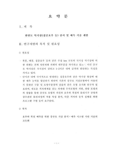
요약문=i,5,7
Summary In English=viii,12,7
목차=xv,19,2
Contents=xvi,21,4
List Of Figures=xxi,25,9
List of Tables=xxx,34,1
제1장 서론=1,35,4
제2장 국내외 기술개발 현황=5,39,1
제1절 고도화된 자료동화 방안의 기반 기술 개발=5,39,2
제2절 차세대 중규모 예측 모델의 개발(II)=6,40,2
제3절 강수 물리 모수화 방안에 대한 민감도 평가와 호우/폭설 기구 규명=7,41,1
제4절 둥지격자 위주의 다중 WRF의 동적 실행을 위한 TCP 통신 구현(위탁연구)=8,42,1
제3장 연구 개발 수행 내용 및 결과=9,43,1
제1절 고도화된 자료동화 방안의 기반 기술 개발=9,43,1
1. 레이더 관측을 포함한 고해상도 물리적 초기화기법 개발=9,43,18
2. 극궤도 위성관측을 활용한 강수량 자료동화 기술개발=27,61,23
3. 한반도 영역의 육지 수문 자료동화 체계의 개선=50,84,15
4. 토앙수분 초기화에 따른 민감도 분석=65,99,21
제2절 차세대 중규모 예측 모델의 개발(II)=86,120,1
1. 지표초기조건이 반영된 고해상도 모델의 모의특성분석=86,120,16
2. 대기-파랑 접합모델의 최적화 및 예측성 평가=102,136,16
3. WRF 모델의 둥지격자 모델 운영을 위한 분산-병렬기법 개발=118,152,5
제3절 강수 물리 모수화 방안에 대한 민감도 평가와 호우/폭설 기구 규명=123,157,1
1. 차세대 중규도 예측 모형에 탑재된 강수관련 물리 모수화 방안들의 민감도 분석=123,157,27
2. 호우와 폭설 현상에 적용하는 기구의 규명=150,184,14
제4절 위탁연구=164,198,1
1. 둥지격자 위주의 다중 WRF의 동적 실행을 위한 TCP 통신 구현=164,198,19
제4장 연구개발목표 달성도 및 대외기여도=183,217,2
제5장 연구개발결과의 활용계획=185,219,2
제6장 연구개발과정에서 수집한 해외 과학기술정보=187,221,2
제7장 참고 문헌=189,223,14
구름규모의 집중호우 역학/물리 과정 연구와 예측기술개발(II) Research On Dynamical And Physical Processes And Technology Development Of Prediction Of Cloud-Scale Heavy Rainfall(II)
구름규모의 집중호우 역학/물리 과정 연구와 예측기술개발(II) Research On Dynamical And Physical Processes And Technology Development Of Prediction Of Cloud-Scale Heavy Rainfall(II)=0,237,1
요약문=i,238,5
Summary=vi,243,5
목차=xi,248,2
Contents=xiii,250,2
List Of Figures=xv,252,9
List Of Tables=xxiv,261,1
제1장 서론=1,262,2
제2장 국내외 기술개발 현황=3,264,3
제3장 연구개발수행 내용 및 결과=6,267,1
제1절 중규모 관측자료 분석=6,267,41
제2절 도플러 레이더 관측 자료의 동화기법=47,308,54
제3절 고해상도 모형 구축 및 집중호우 구조 분석=101,362,20
제4절 구름규모 수치 모형을 위한 초기자료 산출 기술 개발 - 위상 수정 자료동화 기법의 적용=121,382,24
제5절 태풍 상륙과 연관된 집중호우의 예측성 향상=145,406,38
제4장 연구개발목표 달성도 및 대외기여도=183,444,3
제5장 연구개발결과의 활용계획=186,447,2
제6장 연구개발과정에서 수집한 해외과학기술정보=188,449,2
제7장 참고 문헌=190,451,9
한강유역 돌발홍수 예경보시스템(FFG) 개발(II) Development Of Flash Flood Guidance(FFG) On Han River Basin(II)
한강유역 돌발홍수 예경보시스템(FFG) 개발(II) Development Of Flash Flood Guidance(FFG) On Han River Basin(II)=0,460,1
요약문=i,461,5
Summary=vi,466,7
목차=xiii,473,2
Contents=xv,475,2
List Of Figures=xvii,477,7
List Of Tables=xxiv,484,1
제1장 서론=1,485,4
제2장 국내외 기술개발 현황=5,489,1
제1절 국내 기술개발 현황=5,489,2
제2절 국외 기술개발 현황=7,491,3
제3장 연구개발수행 내용 및 결과=10,494,1
제1절 돌발홍수 예경보시스템(FFG)=10,494,1
1. 돌발홍수 예경보시스템의 기본개념=10,494,3
2. 한계유출량 산정모형=12,496,9
3. 토양수분 산정모형=21,505,19
4. 돌발홍수능 산정 이론=39,523,2
5. 레이더 강우량 추정이론=40,524,10
제2절 레이더 추정 유역평균 강우량 계산=50,534,1
1. 관악산 레이더 DB 구축 및 POD 분석=50,534,12
2. 레이더 추정 강우량 편차보정 분석=61,545,6
3. 레이더 추정 강우량의 수문학적 적용=66,550,5
제3절 돌발홍수 모델의 유역평균 예측강우량 산정=71,555,1
1. 기상청 지역예보모델(RDAPS)=71,555,9
2. RDAPS 자료의 기상학적 신뢰도 분석=80,564,14
3. 유역평균 예측강우량 산정을 통한 수문학적 신뢰도 분석=94,578,12
4. 유역기반 예측강우량의 수문학적 적용=105,589,14
제4절 유역기반 강우량의 수문학적 불확실성 해석=119,603,1
1. 수문학적 불확실성 분석 개념=119,603,3
2. 레이더 추정 강우량의 불확실성 해석=121,605,7
3. RDAPS 예측 강우량의 불확실성 해석=127,611,5
제5절 유역기반 및 격자형 FFG 산정=132,616,1
1. 예보시간별 한계유출량 산정=132,616,8
2. 모델기반 토양수분 추정=139,623,12
3. 유역기반 및 격자형 FFG 산정=150,634,4
제6절 실시간 FFG 운영체계 설계=154,638,1
1. 실시간 FFG 운영체계 설계 개요=154,638,2
2. FFG 운영시스템 설계방향=155,639,2
3. FFG 운영시스템 전처리 과정 설계=156,640,7
3. FFG 운영시스템 해석모듈 구동을 위한 연결구조 설계=162,646,2
4. FFG 운영시스템 후처리 과정 설계=163,647,1
제4장 연구개발목표 달성도 및 대외기여도=164,648,3
제5장 연구개발결과의 활용계획=167,651,2
제6장 연구개발과정에서 수집한 해외과학기술정보=169,653,1
1. 미국 RFC 연계기술 현황=169,653,9
2. 미국 USBR 연계기술 현황=177,661,15
3. 미국 TVA 연계기술 현황=191,675,5
4. 일본 댐통합관리사무소 연계기술 현황=195,679,6
제7장 참고문헌=201,685,4
Fig. 3.1.1. Distribution Of Radar Sites=10,44,1
Fig. 3.1.2. The Flow Diagram Of Composition Of Radar Reflectivity=11,45,1
Fig. 3.1.3. Maximum Radar Reflectivity For Baekryongdo (a), Donghae (b), Gunsan (c), Gwanaksan (d), Gosan (e) And Busan (f) Site At 00 UTE 22 July, 2002=12,46,1
Fig. 3.1.4. Maximum (a) And Vertical (b) Radar Reflectivity At 00 UTC 22 July, 2002=12,46,1
Fig. 3.1.5. The Horizontal (850 hPa) And Vertical Distributton Of Cloud Cover Of The First Guess Fields (a,c) And Analysis (b,d) After Inserting The Satellite And METAR data=14,48,1
Fig. 3.1.6. The Horizontal (850 hPa) And Vertical Distribution Of Cloud Covcr Analysis And 1Hour Simulated Rainfall Amount After Inserting Radar Reflectivity With 0 dBZ (a,d,g), 13 dBZ (Lower), 20 dBZ (Upper) (b,e,h), 30 dBZ (Lower), 40 dBZ (Upper) (c,f,i) Threshold=15,49,1
Fig. 3.1.7. The Cycle Of Shot-Range Analysis And Prediction System=16,50,1
Fig. 3.1.8. The Model Domain And Terrain Height=17,51,1
Fig. 3.1.9. Daily Rainfall Amounts At 5 Cities For July And August, 2002=18,52,1
Fig. 3.1.10. The Analysis And 1 Hour Simulated Field Of 750 hPa Wind And Vertical Velocity For CTL(a,e), EXPI (b,f), EXP2 (c,g) And EXP3 (d,h), Respectively=20,54,1
Fig. 3.1.11. Same As Fig. 3.1.10 Except For 850 hPa Wind And Simulated Reflectivity=20,54,1
Fig. 3.1.12. Same As Fig 3.1.10. Except For Vertical Cross Section Of Wind And Simulated Reflectivity Along The AA' In Fig. 3.1.11 (h)=21,55,1
Fig. 3.1.13. The Domain Averaged Vertical Distributions Of Cloud Water/Ice Mixing Ratio (a,b) And Rain, Snow, Graupel Mixing Ratio (c,d) For Analysis (a,c) And 1 Hour Simulated Field (b,d), Respectively=21,55,1
Fig. 3.1.14. The Hourly Accumulated Precipitation Amounts For AWS Observation (a) And CTL (b), EXP1 (c), EXP2 (d) And EXP3 (e) Experiments Valid At 01 UTC July 22, 2002=22,56,1
Fig. 3.1.15. The Same As Fig. 3.1.14. Except For 02 UTC July 22, 2002=23,57,1
Fig. 3.1.16. The Hourly Accumulated Precipitation Amounts For CTL (a,b,c) And Restart (d,e,f) Experiment Without Cloud And Precipitation At 06 UTC, 07 UTC And 08 UTC July 22, 2002, Respectively=23,57,1
Fig. 3.1.17. Threat (a,b) And Bias (c,d) Score Of C18N6, H18N6 And H18H6 Experiment For The Threshotd 2.54 mm (a,c) And 12.7 mm (b,d), Respectively=25,59,1
Fig. 3.1.18. The Model Domain And Terrain Height=30,64,1
Fig. 3.1.19. The Flow Diagram Of Assimilation On MM5=31,65,1
Fig. 3.1.20. Surface Charts At 6-H Intervals From 0000 UTC 24 June To 0600 UTC 25 June 2004=33,67,1
Fig. 3.1.21. AWS 1-Hour Accumulated Rainfall At 3-H Intervals From 0300 UTC 24 June To 1800 UTC 25 June 2004=34,68,1
Fig. 3.1.22. Enhanced Infrared Images From The GOES-9 Satellite At 3-H Intervals From 1800 UTC 23 June To 0900 UTC 24 June 2004=34,68,1
Fig. 3.1.23. Satellite-Derived Rain Rates From SSM/I At 0054 UTC 24 June 2004 (a) And Radar Rain Rates At 0050 UTC 24 June 2004 (b)=35,69,1
Fig. 3.1.24. Design Of Numerical Experiments For Case I=35,69,1
Fig. 3.1.25. The 1-Hour Accumulated Precipitation At (a) 0100, (b) 0200, (c) 0300, And (d) 0400 UTC 24 June 2004 For The Control Run Che 1-Hour Accumlated Precipitation At (a) 0100, (b) 0200, (c) 0300, And (d) 0400 UTC 24 June 2004 For The Experiment Run=37,71,1
Fig. 3.1.26. The Differences Of Sea-Level Pressure Between Control Run And Experiment Run At (a) 0100, (b) 0200, (c) 0300, And (d) 0400 UTC 24 June 2004 (0.1 hPa INterval)=38,72,1
Fig. 3.1.27. The Same As Fig. 3.1.26. Except For The Temperature At 500 hPa Level (0.1 K Interval)=39,73,1
Fig. 3.1.28. The Time Seriew Of Mean Temperature (a) Mixing Ratio (b) And Vertical Velocity (c) Within 30˚N~35˚N And 120˚E~130˚E Area (Solid Lines For Control Run And Dotted Lines For Assimilation Run)=40,74,1
Fig. 3.1.29. The Temporaily And Spatially Averaged Differences Of Temperature (a) Mixing Ratio (b) And Vertical Velocity (c) Between Control Run And Assimilation Run Within 30˚N~35˚N And 120˚E~130˚E Area During 6 Hours After Assimilation=41,75,1
Fig. 3.1.30. The 10-Minute Accumulated Precipitation Over 30˚N~35˚N And 120˚E~130˚E Area And The Ratio Of Precipitation By Cumulus Parameterization Scheme And Microphysics Scheme For Control(a) And Experiment(b)=41,75,1
Fig. 3.1.31. Surface Charts At 6-H Intervals From 1800 UTC 18 June To 0000 UTC 20 June 2004=43,77,1
Fig. 3.1.32. Enhanced Infrared Images From The GOES-9 Satellite At 1-H Interval From 2100 UTC 18 June To 0200 UTC 19 June 2004=44,78,1
Fig. 3.1.33. Satellite-Derived Rain Rates From SSM/I At 2306 UTC 18 June 2004 (a) And Radar Rain Rate At 2310 UTC 18 June 2004 (b)=44,78,1
Fig. 3.1.34. Design Of Numerical Experiments For Case II=45,79,1
Fig. 3.1.35. The 1-Hour Accumulated Precipitation At (a) 2300 UTC 18, (b) 0000 UTC 19, (c) 0100 UTC 19 And (d) 0200 UTC 19 June 2004 For The Control Run ; The 1-Hour Accumulated Precipitation At (a) 2300 UTC 18, (b) 0000 UTC 19, (c) 0100 UTC 19 And (d) 0200 UTC 19 JUNE 2004 For The Experiment Run=46,80,1
Fig. 3.1.36. The Time Series Of Mean Temperature (a), Mixing Ratio (b) And Vertical Velocity (c) Within 30˚N~40˚N And 120˚E~130˚E Area (Solid Lines For Conrol Run And Dotted Lines For Assimilation Run)=47,81,1
Fig. 3.1.37. The 10-Minute Accumulated Precipitation Over 30˚N~40˚N And 120˚E~130˚E Area And The Ratio Of Precipitation By Cumulus Parameterization Scheme And Microphysics Scheme For Control(a) And Experimen(b)=48,82,1
Fig. 3.1.38. Soil Moisture Profile At Cholwon And Sunchon Station=52,86,1
Fig. 3.1.39. Simple Scattering Diagram Of Soil Moisture Vs Hourly Precipitation At Cholwon (Upper Four Panel) And Suncheon (Lower Four Panel)=54,88,1
Fig. 3.1.40. Simple Tracing Of The Scattering Diagram During The Most Wet Period At Cholwon (Left) And Sunchon (Right)=55,89,1
Fig. 3.1.41. Temporal Variation Of Soil Moisture And Precipitation During Wet Season. There Are Some Missing Value In The Circle A=56,90,1
Fig. 3.1.42. Same As Fig. 3.1.41. Except For Dry Season=56,90,1
Fig. 3.1.43. Same As Fig. 3.1.41 Except For Sunchon=57,91,1
Fig. 3.1.44. Same As Fig. 3.1.42 Except For Sunchon=57,91,1
Fig. 3.1.45. Sensitivity Of The Laps Soil Moisture Against Hourly Precipitation. The Soil Types Are Sand And Loam For Each Case=58,92,1
Fig. 3.1.46. Surface Map Of 1600, 1700, 1800 And 1900 Utc Jun 2004=61,95,1
Fig. 3.1.47. The Observed Hourly Rainfall Distribution At 6.18:15 And 6.19:00 (LST)=62,96,1
Fig. 3.1.48. The Evolution Of Soil Moisture In WRF-Noah Coupled System. Exp. 1. Uses Laps Soil Moisture For Sand And Exp. 2 Uses Laps Soil Moisture For Loam As Initial Condition=62,96,1
Fig. 3.1.49. Same As Fig. 3.1.48 Except For Soil Temperature=63,97,1
Fig. 3.1.50. Same As Fig. 3.1.48 Except For Precipitation, "Rainc" Means "Accumulated Total Cumulus Precipitation" And "Rainnc" Means "Accumulated Total Grid Scale Precipitation"=63,97,1
Fig. 3.1.51. Erosion Threshold Wind Velocities As A Function Of The Gravimetric Soil Moisture. Data From (2): Bisal And Hsieh (1966); (5): Chen Et Al. (1996). (From Fecan et al., 1999)(이미지 참조)=67,101,1
Fig. 3.1.52. Soil Moisture Fields Of NCEP Reanalysis-2 Data. Negative Values Are Shaded In Difference Field (c), (f)=68,102,1
Fig. 3.1.53. Surface Weather Chart At 00 UTC March 10, 2004=69,103,1
Fig. 3.1.54. Model Domain And Its Soil Types=71,105,1
Fig. 3.1.55. Difference Of Relative Humidity (%) Between LSM And CTL At (a) 00 UTC March 10 And (b) 00 UTC March 11, 2004. Negative Values Are Shaded=73,107,1
Fig. 3.1.56. As In Fig. 3.1.55 Except For 2 m Temperature=73,107,1
Fig. 3.1.57. As In Fig. 3.1.55 Except For 10 m Wind=74,108,1
Fig. 3.1.58. As In Fig. 3.1.55 Except For Water Vapor Mixing Ratio=75,109,1
Fig. 3.1.59. Surface Weather Chart At 12 UTC June 18, 2004=77,111,1
Fig. 3.1.60. AWS Daily Rainfall (mm) At (a) June 19 And (b) 20, 2004=77,111,1
Fig. 3.1.61. The Satellite IR Image Of Goes-9 At 12 UTC June 18, 2004=78,112,1
Fig. 3.1.62. Multi Nested Model Domains And Its Landuse Type=78,112,1
Fig. 3.1.63. 6H Accumulated Rainfall (Mm) Of CTL And LSM During Simulation Period=80,114,1
Fig. 3.1.64. Soil Moisture Fields Of SM1 (5 cm Below Surface), SM2 (25 cm), SM3 (70 cm), And SM4 (150 cm) During Simulation Period=80,114,1
Fig. 3.1.65. Time Series Of 30 Min Rainfall (mm) And Soil Moisture At Majang Station=81,115,1
Fig. 3.1.66. Time Series Of Surface Latent Heat Flux (W/m²) Of CTL And LSM At Majang Station=82,116,1
Fig. 3.1.67. Time Series Of (a) Ih Rainfall (mm) And Temperature (℃) Of AWS And (b) 2 M Temperature (℃) Of Simulation CTL And LSM At Majang Station=83,117,1
Fig. 3.1.68. 6H Accumulated Rainfall (mm) Of (a) AVN CTL, (b) NCEP2 CTL, (c) AVN LSM, (d) NCEP2 LSM And AWS (Left) At 00 UTC June 20, 2004=84,118,1
Fig. 3.2.1. (a) Topography Of Studied Domain From USGS 30" Data And (b) More Detailed Map From Sub-Box In (a). The Cross Section A, B, C And D Are For One-Dimensional Spectral Analysis=88,122,1
Fig. 3.2.2. Terrain Height Variance Spectra For Cross Sections In Fig. 3.2.1. One-Dimensional Power Spectra Of A, B, C And D Cross Section In Fig. 3.2.1 Correspond To (a), (b), (c) And (d)=90,124,1
Fig. 3.2.3. The Resolved Terrain Variance Spectra (Percentages) For Model Resolution (Left Column) And The Ratios Of Subgrid-Scale Terrain Height Variance To Model-Resolved Terrain Height Variance (Right Column) As Cross Sections Of Fig. 3.2.1(a)=92,126,1
Fig. 3.2.4. Contours Of Log Spectral Power (m²/km²) Contained In The Terrain Height Of Korean Peninsula (Fig. 3.2.1 (a)), (a) Wavenumbers Between 0 And 0.5 km-1. (b) A Detail For Wavenumbers Between 0 And 0.12 km-1(이미지 참조)=94,128,1
Fig. 3.2.5. Terrain Height Variance Spectra For AA And BB Cross Section In Fig. 3.2.4 (a)=94,128,1
Fig. 3.2.6. Synoptic Surface Pressure Map From KMA At (a) 00 UTC And (b) 12 UTC 15 July 2004=97,131,1
Fig. 3.2.7. Simulated Wind Stream Lines At Lowest Model Layer For 2000 UTC 14 July 2004=98,132,1
Fig. 3.2.8. Same As Fig. 3.2.7 But At 00 UTC 25 July 2004=99,133,1
Fig. 3.2.9. Root Mean Square Vector Errors And Unbiased Root Mean Square Vector Errors For Model Simulation With Different Resolution=100,134,1
Fig. 3.2.10. Schematic Diagram Of Coupled WRF-WW3 Model (CWW) By Multi-Component-Single-Executable (MCSE) Method=105,139,1
Fig. 3.2.11. The Multi-Processor Loading Program Of WRF (wrf) And WW3 (w3shel) Using Single Execution=105,139,1
Fig. 3.2.12. Simulation Domain Used For CWW (Coupled WRF-WW3 Model). The Horizontal Resolutions Of WRF And WW3 Are 18 Km And 1/6 Degrees Respectively=107,141,1
Fig. 3.2.13. Surface Analysis Chart Of 1200 UTC 24 July 2004=109,143,1
Fig. 3.2.14. Coupled Simulation Of Nondimensional Charnock Parameter On (a) 1800 UTC 14 July And (b) 0000 UTC 15 July 2004=109,143,1
Fig. 3.2.15. Sensible Heat Flux (Wm-2) Of Coupled Simulation (CWW) On (a) 1800 UTC 14 July And (b) 0000 UTC 15 July 2004. Negative Heat Flux Represented By Dotted Contour Line(이미지 참조)=111,145,1
Fig. 3.2.16. Latent Heat Flux (Wm-2) And Wind Vector (10 m) Of Coupled Simulation (CWW) On (a) 1800 UTC 14 July And (b) 0000 UTC 15 July 2004(이미지 참조)=111,145,1
Fig. 3.2.17. The Stream Line Of Surface Wind Difference Between CWW And N032 On (a) 1800 UTC 14 And (b) 0000 UTC 15 July 2004=113,147,1
Fig. 3.2.18. Same As In Fig. 3.2.17 Except For N018=113,147,1
Fig. 3.2.19. The Difference Of Latent Heat Flux (Wm-2) Between CWW And N032 On (a) 1800 Utc 14 And (b) 0000 Utc 15 July 2004(이미지 참조)=115,149,1
Fig. 3.2.20. Same As In Fig. 3.2.19 Except N032=115,149,1
Fig. 3.2.21. Roughness Length (m) Of (a) CWW Vs N032 And (b) CWW Vs N018 On 0300 UTC 14 July 2004=116,150,1
Fig. 3.2.22. Componentized Coupling Encompasses Two Modes Of Execution, Sequential And Concurrent. Sequentially Coupled Components Execute In Sequence Over The Span Of The Coupling Interval. Interpolation And Movement Of Forcing Data Between Coupled Components Occurs Between Executions Of The Components. On Parallel Systems, All The Components Are Decomposed Over The Complete Set Of Processors And The Interpolation And Movement Of Data Involves Interprocessor Communication To Map Data From The Forcing Component's Grod To The Forced Component's Grid (Adopted From Michalakes et al. (2003))=119,153,1
Fig. 3.2.23. Schematic Diagram Of Coupled WRR-WRF (Nesting) By Multi-Component-Single- Executable (MCSE) Method=121,155,1
Fig. 3.2.24. The Multi-Processor Loading Program Of Wrfens01 And Wrfens02 Using Single Execution=121,155,1
Fig. 3.2.25. The Subroutine Program Of Wrfens01 (Left) And Wrfens02 (Right)=122,156,1
Fig. 3.3.1. The Flowchart Of WRF Ver. 2.0=124,158,1
Fig. 3.3.2. Model Domain For Domain 1 (18 Km) And Domain 2 (6 Km)=128,162,1
Fig. 3.3.3. Illustration Of Microphysics Processes=129,163,1
Fig. 3.3.4. Illustration Of Cumulus Processes=130,164,1
Fig. 3.3.5. Daily Precipitation (Mm/24Hours) During Experiment Period=132,166,1
Fig. 3.3.6. Six-Hour Surface Weather Charts (Upper), GOES Enhanced Ir Imageries (Middle), And Radar Imageries (Lower) From 0000 To 1800 UTC 20 June 2004=133,167,1
Fig. 3.3.7. Same As Fig. 3.3.6 Except For 0000 To 1800 UTC 20 June 2004=133,167,1
Fig. 3.3.8. Same As Fig. 3.3.6 Except For 0000 To 1800 UTC 24 June 2004=134,168,1
Fig. 3.3.9. Same As Fig. 3.3.6 Except For 0000 To 1800 UTC 5 June 2003=134,168,1
Fig. 3.3.10. Equivalent Potential Temperature With Horizontal Wind Vector (Left Column) And Column Integrated Total Hydrometeor (mm) With Mean Surface Level Pressure At (a) 0600 Utc 5 March 2004, (b) 0600 UTC 20 June 2004, (c) 0600 UTC 24 June 2004, (d) 0000 UTC 6 August 2003=136,170,1
Fig. 3.3.11. [Left] Cloud Water Mixing Ratio (Solid), Cloud Ice Mixing Ratio (Dashed), Circulation Vector And [Right] Rain Water Mixing Ratio (Solid), Snow Mixing Ratio (Dashed), Graupel Mixing Ratio (Shaded), Temperature (Line Horizontally Drawn) In (a) WSM6, (b) WSM5, (c) WSM3 At 20 June 0600 UTC (12 Fcst)=137,171,1
Fig. 3.3.12. [Left] Cloud Water Mixing Ratio (Solid), Cloud Ice Mixing Ratio (Dashed), Circulation Vector And [Right] Rain Water Mixing Ratio (Solid), Snow Mixing Ratio (Dashed), Graupel Mixing Ratio (Shaded), Temperature (Line Horizontally Drawn) In (a) WSM6, (b) Lin_et-al, (c) Ferrier (New Eta) At 20 June 0600UTC (12 Fcst)=139,173,1
Fig. 3.3.13. 6 Hour-Accumulated Precipitation Of Cumulus Partdeft], Explicit Part[Middle], Sum Of Cumulus And Explicit Part In (a) Wsm6, (b) Lin_et_al, (c) Ferrier (New Eta.) At 20 June 0000 UTC (06 Fcst)=140,174,1
Fig. 3.3.14. Same As Fig. 3.3.13 Except For 20 June 0600 UTC (12 Fcst)=141,175,1
Fig. 3.3.15. [Left] Cloud Water Mixing Ratio (Solid), Cloud Ice Mixing Ratio (Dashed), Circulation Vector And [Right] Rain Water Mixing Ratio (Solid), Snow Mixing Ratio (Dashed), Graupel Mixing Ratio (Shaded), Temperature (Line Horizontally Drawn) In (a) WSM6, (b) Lin_et-al, (c) Ferrier (New Eta) At 5 March 0600UTC (18 Fcst)=142,176,1
Fig. 3.3.16. 6 Hour-Accumulated Precipitation Of Cumulus Partdeft], Explicit Part[Middle], Sum Of Cumulus And Explicit Part In (a) WSM6, (b) Lm_et_al, (c) Ferrier (New Eta) At 5 March 0600 UTC (18 Fcst)=143,177,1
Fig. 3.3.17. [From Left] 6 Hour-Accumulated Precipitation Of Cumulus Part, Explicit Part, Sum Of Cumulus And Explicit Part And CAPE In (a) Kain-Fritsch, (b) Grell-Devenyi Ensemble, (c) Betts-Miller-Janjic With WSM6 At 20 June 0600 UTC (12 Fcst)=144,178,1
Fig. 3.3.18. [Left] CAPE And [Right] 6 Hour-Accumulated Precipitation In (a) Kain-Fritsch, (b) No Cumulus Parameterization With Wsm6 At 20 June 0600 UTC (12 Fcst)=145,179,1
Fig. 3.3.19. (a) Cloud Water Mixing Ratio (Solid), Cloud Ice Mixing Ratio (Dashed), (b) Rain Water Mixing Ratio (Solid), Snow Mixing Ratio (Dashed), Graupel Mixing Ratio (Shaded), Temperature (Line Horizontally Drawn), (c) Equivalent Potential Temperature And Circulation Vector, (d) 6 Hour-Accumulated Precipitation At [Left] 5 March 0600 UTC (18 Fcst), [Right] 20 June 0600 UTC (12 Fcst)=146,180,1
Fig. 3.3.20. Same As Fig. 3.3.19 Except For (a) 18Km Domain With Kain-Fritsch, (b) 18Km Domain Without Cumulus Parameterization, (c) 6Km Domain With Kain-Fritsch, (c) 6Km Domain Without Cumulus Parameterization At 20 June 0600 UTC (12 Fcst)=147,181,1
Fig. 3.3.21. 6 Hour-Accumulated Precipitation In (a), (c) And Cloud Water Mixing Ratio(Shaded), Divergence (Solid And Dashed), Temperature (Line Horizontally Drawn) In (d), (e) And Radar-Echo Of Mt. Gwangduk In (c), (a), (d) With Kain-Fritsch, (c), (e) Without Cumulus Parameterization With WSM6 At 20 June 0600 UTC (12 Fcst)=148,182,1
Fig. 3.3.22. (a) Surface Weather Chart, (b) GEOS Enhanced IR Images, (c) Distribution Of Lightening For 1 Hours, And (d) 6-Hour Accumulated Rainfall By Aws From 1800 UTC 4 To 1800 UTC 5 March 2004=152,186,1
Fig. 3.3.23. (a) Cloud Water Mixing Ratio(Solid), Cloud Ice Mixing Ratio(Dashed), (b) Equivalent Potential Temperature And Circulation Vector, (c) CAPE, (d) CIN At 0600 UTC 5 March 2004=154,188,1
Fig. 3.3.24. (a) CAPE, (b) CIN, (c) SREH, (d) 6 Hour-Accumulated Precipitation At 0600 UTC 5 March 2004=154,188,2
Fig. 3.3.25. Same As Fig. 3.3.22 Except For The Period From 0000 UTC 20 To 0000 UTC 21 June 2004=156,190,1
Fig. 3.3.26. Same As Fig. 3.3.23 Except For 0600 UTC 20 June 2004=157,191,1
Fig. 3.3.27. Same As Fig. 3.3.24 Except For 0600 UTC 20 June 2004=157,191,1
Fig. 3.3.28. Same As Fig. 3.3.22 Except For The Period From 0000 UTC 24 To 0000 UTC 25 June 2004=159,193,1
Fig. 3.3.29. Same As Fig. 3.3.23 Except For 0600 UTC 24 June 2004=160,194,1
Fig. 3.3.30. Same As Fig. 3.3.24 Except For 0600 UTC 24 June 2004=160,194,1
Fig. 3.3.31. Same As Fig. 3.3.22 Except For The Period From 0600 UTC 5 To 0600 UTC 6 August 2003=161,195,1
Fig. 3.3.32. Same As Fig. 3.3.23 Except For 0000 UTC 6 August 2003=162,196,1
Fig. 3.3.33. Same As Fig. 3.3.24 Except For 0000 UTC 6 August 2003=162,196,1
Fig. 3.4.1. The Structure Of Nested Domains Of WRF=165,199,1
Fig. 3.4.2. Illustration Of Nested Domains=166,200,1
Fig. 3.4.3. Improved Computation Of Nested Domains=167,201,1
Fig. 3.4.4. A Sender And A Receiver Using TCP=170,204,1
Fig. 3.4.5. Data Allocation In The Parallel WRF Program=177,211,1
Fig. 3.4.6. Execution Of Two Different WRF Models=180,214,1
Fig. 3.4.7. Wind Difference Of A WRF Model After Receiving Boundary Data(Cont)=181,215,1
Fig. 3.4.7. Wind Difference Of A WRF Model After Receiving Boundary Data=182,216,1
Fig. 1.1. Topographical Distribution And Radar Coverage Of WSR-88D Doppler Radar At RKJK And Rplsg With 50 Km Intervals, Respectively=7,268,1
Fig. 1.2. Distribution Of 48-Hour And 12-Hour Accumulated Precipitation For Heavy Rainfall Cases=12,273,1
Fig. 1.3. GOES-9 Visible Imagery And JMH Charts Of Surface, 700 hPa, 500 hPa And 200 hPa At 00 UTC 9 July 2003=16,277,1
Fig. 1.4. Same As In Fig. 1.3 Except For At 00 UTC 6 August 2003=17,278,1
Fig. 1.5. Skew-T Log-P Chart At 0000 UTC 25 July 2003 (a) And 0000 UTC 09 July 2003 (b), Respectively=20,281,1
Fig. 1.6. Time-Height Cross-Section Of Equivalent Potential Temperature, Relative Humidity=21,282,1
Fig. 1.7. Same As In Fig. 1. 6 Except For Distance-Height Cross-Section=22,283,1
Fig. 1.8. Satellite Imagery (GMS-5 For (a), GEOS-9 For (b)-(c)) And Corresponding Reflectivity Of WSR-88D Doppler Radar Each From 1130UTC 26 To 0230 UTC 27 July 1996 (a), From 0900 UTC To 1200 Utc 24 August 2003 (b), And 2300 UTC 8 To 0200 UTC 9 July 2003 (c), Respectively=24,285,1
Fig. 1.9. The Meso-Analysis Chart Using Surface Observation Data At (a) 0600 UTC And (b) 0900 UTC 26 July 1996. The Thick Solid Lines Denote Pressure (hPa) And Dotted Lines Temperature (℃). ★'S Denote Approximate Location Of The Initiation Of MCS A And B=30,291,1
Fig. 1.10. Surface Temperature And Wind Fields At (a) 0030 UTC 25 July 2003 And (b) 0900 UTC 24 August 2003 From Automated Weather System In KMA. Small Box At Left Bottom Shows Reflectivity Of Corresponding Time=31,292,1
Fig. 1.11. The Composite Reflectivity (CR) (Left Panels), Storm-Relative Velocity (SR) (Middle Panels), And Base Velocity (BV) (Right Panels) From (a) 1000 UTC Through (e) 1200 Utc 26 July 1996 With 30-Minute Intervals, Respectively. The Green Colors Denote Invound (Toward Radar) While The Red Colors Refer To Outbound (Away From The Radar) And The Yellow Circles In Thick Dashed Lines In (d) And (e) Denote Mesocyclone Activities=35,296,1
Fig. 1.12. The Cross-Section Of Reflectivity And Base Velocity Perpendicular To MCS Movement (North-South) Following The Strongest Storm In MCS From 1010 UTC To 1230 UTC With 10-Minute Intervals, Respectively.(Upper Panel) And The Cross-Section Of (a) Reflectivity, (b) Base Velocity, And (c) Storm-Relative Velocity At 1150 UTC 26 Along The Line E-F Shown In Fig. 1. 10e. In (b) ⊙ Denotes The Wind Direction Out Of Page And ⓧ Denotes Wind Direction Into The Page. (Lower Penel)=36,297,1
Fig. 1.13. Composite Reflectivity Of Greater Than 40 dBZ From 1800 UTC 26 To 0300 UTC With 1-Hour Intervals. The Dotted Lines Refer Representto A Small Clusters And The Solid Lines Mean Represent A Large Clusters. The Numbers In The Clusters Denote Small Convective Cells=37,298,1
Fig. 1.14. Reflectivity Of WSR-88D From 0800 UTC To 2100 UTC 24 August 2003 And 1800 UTC 17 To 0700 UTC 18 September 2003=39,300,2
Fig. 1.15. The Boundaries Of Convective Storm Boundaries (a) From 1000 UTC To 1500 UTC 26 For The First MCS, And (b) From 1801 UTC 26 To 0232 Utc 27 July For The Second MCS. The Open Arrows With Light Shading Show The Temporal Change Of Boundaries. The Thick Arrows At The Right Sides Denote The Mean Movement Of Individual Cells. (CC), The Mouvement Of Storm System (CS), The Propagation Vectors (PS), And The Environmental Wind Speed Resulted From Osan Rawindsonde Data (We)=42,303,1
Fig. 1.16. Correlation Between 1H-Accumulated Rainfall Amount And DMSP IR=44,305,1
Fig. 1.17. (a) DMSP F14 OLS Infrared Image At 11:24 UTC 6 August 2003 (b) Rainfall Amount Observed At Surface Station And (C) Rainfall Amount Estimated By Regression Multiple Linear Regression Equation At 11 UTC 6 August 2003=46,307,1
Fig. 2.1. (a) 24-Hr Accumulated Rainfall Amount From 00 UTC, 6 To 00 UTC, 7 August 2003, And (b) 6-Hr Accumulated Rainfall Amount From 1200 UTC To 18 UTC, 6 Aug. 2003=49,310,1
Fig. 2.2. (a) - (h) 1-Hr Accumulated Rainfall Amount From 1200 UTC To 1900 UTC, 6 Aug. 2003, Respectively=50,311,1
Fig. 2.3. Surface Weather Charts From Jma At (a) 0600 UTC, (b) 1200 UTC, (c) 1800 UTC 6 And (d) 0000 UTC 7 Aug. 2003=52,313,1
Fig. 2.4. 850 hPa Charts From Avn (a) 06 UTC, (b) 12 UTC, (c) 18 UTC 6 And (d) 00 UTC 7 Aug. 2003=53,314,1
Fig. 2.5. 500 hPa Charts From AVN (a) 06 UTC, (b) 12 UTC, (c) 18 UTC 6 And (d) 00 UTC 7 Aug. 2003=54,315,1
Fig. 2.6. 200 hPa Charts From AVN (a) 06 Utc, (b) 12 UTC, (c) 18 UTC 6 And (d) 00 UTC 7 Aug. 2003=55,316,1
Fig. 2.7. Radar Reflectivity From KMA At (a) 13 UTC, (b) 14 UTC, (c) 15 UTC 6, (d) 16 UTC, (e) 17 UTC And , (f) 18 UTC 6 Aug. 2003=57,318,1
Fig. 2.8. Vertical Cross Section Of Radar Reflectivity From WWR-88D (RKSG) Over Cheorwon At (a) 11 UTC, (b) 12 UTC, (c) 13 UTC, (d) 14 UTC, (e) 15 UTC And, (f) 16 UTC 6 Aug. 2003=58,319,1
Fig. 2.9. Horizontal Radial Velocity At (a) 12 UTC, (b) 15 UTC 6 Aug. 2003=59,320,1
Fig. 2.10. The Diagram Precipitation And Severe Weather Scan Volume Pattern 21 Of WSR-88D. The Shaded Area Represents Radar Detectable Area And The Blank Area Represents Undetectable Area. The Numbers Of Right And Upper Axis Represent Elevation Angles=61,322,1
Fig. 2.11. The Horizontal Wind Distribution Calculated From Radial Velocity Of The Synthesized WSR-88Dat 5 Km Level=63,324,1
Fig. 2.12. (a) Rain Water Mixing Ratio Distribution On (a) 3 Km And, (b) 5.5 Km Level From Radar At 120000 UTC 6 Aug. 2003=63,324,1
Fig. 2.13. Schematic Of Sensitivity Test Design For Radar Data Assimilation=65,326,1
Fig. 2.14. Rainwater Mixing Ratio Distribution From CTL_10 Km On (a) 850 hPa, (b) 700 hPa, (c) 500 hPa And From RNW_.10 Km On (d) 850 Hpa, (e) 700 hPa, (f) 500 hPa At 12 UTC 6 Aug. 2003=66,327,1
Fig. 2.15. Horizontal Wind Distribution From CTL_3.3 Km On (a) 850 hPa, (b) 700 hPa, (C) 500 hPa And From WND_3.3 Km On (d) 850 hPa, (e) 700 hPa, (f) 500 hPa At 12 UTC 6 Aug. 2003=67,328,1
Fig. 2.16. The 6Hr-Accumulated Rainfall (a), (b) CTL_10 Km, (C), (D) RNW_10 Km, (e), (f) WND_10 Km And (g), (h) RNW+WND_10 Km From 12 UTC To 0700 UTC 6 Aug. 2003=69,330,1
Fig. 2.17. The 6Hr-Accumulated Rainfall (a), (b) CTL_3.3 Km, (c), (d) RNW_3-3 Km, (e), (f) Wnd_3.3 Km And (g), (h) RNW+WND_3.3 Km From 12 UTC To 0700 UTC 6 Aug. 2003=71,332,1
Fig. 2.18. The 1hr- Accumulated Rainfail (a), (b) CTL_3.3 Km, (c), (d) RNW_3.3 Km, (e), (f) Wndj3.3 Km And (g), (y) RNW+WND_3.3 Km At 13 UTC And 14 UTC 6 Aug. 2003=74,335,1
Fig. 2.19. Time Series Of 1-Hour Accumulated Total Rain Water Amount Over (a) "A" Box And (b) "B" Box In The Left Upper Panel From 12 UTC 6 To 00 UTC 7 Aug. 2003=77,338,1
Fig. 2.20. (a) Vertical Distribution Of Temperature Deviation Over Chorwon At 1500 Utc 6 Aug. 2000. The Cross-Section Of Equivalent Potential Temperature(K) Difference Of (b), (c) RNW_3.3 Km - CTL_3.3 Km And (d), (e) WND_3.3 Km-CTL_3.3 Km At 13 And 15 UTC 6 Aug. 2003=79,340,1
Fig. 2.21. The Cross-Section Of Convergence/Divergence Field, Cross-Sectional Wind Component (M/S), And Vertical Velocity (Cm/S) Of (a), (b) CTL_3.3 Km And (c), (d) WND_3.3 Km Along Line In The Left Upper Panel At 12 And 14 UTC 6 Aug. 2003=81,342,1
Fig. 2.22. (a), (b) The Cross-Section Of Rain Water Mixing Ratio (G/Kg) Difference Between RNW_3.3 Km And CTL_3.3 Km And (c), (d) Between WND_3.3 Km And CTL.3.3 Km At 12 And 13 UTC 6 Aug. 2003=83,344,1
Fig. 2.23. Schematic Of Nudging, RUC Experiments=87,348,1
Fig. 2.24. The 6Hr-Accumulated Rainfall Of (a) Ctl, (b) Nud.1, (c) Nud.2, (d) Nud.4, (e) Nud.7, (f) Nud.8.=89,350,1
Fig. 2.20. The 1hr Accumulated Rainfall Of (a) - (f) Ctl, (g) - (l) Nud. 7 From 13 UTC To 18 UTC 6 Aug. 2003, Respectively=90,351,1
Fig. 2.26. Time Series Of Ihr-Rain Amount Peak Over Chorwon From 12 UTC To 18 UTC 6 Aug. 2003=92,353,1
Fig. 2.27. The 6Hr-Accumulated Rainfall Of (a) CTL_3.3 Km, (b) Rainwater RUC, (c) Wind RUC, (d) Rain Water+Wind RUC, Respectively=94,355,1
Fig. 2.28. The 1hr-Accumulated Rainfall Of (a) - (f) Wind RUC, (g) - (l) Rain Water-Wind RUC From 1300 UTC To 18 UTC 6 Aug. 2003, Respectively=95,356,1
Fig. 2.29. Comparison Of Threat Scores Between Ctl, Rain Water And Wind Data Assimilation For (a) 2.5 mm, (b) 5 mm, (c) 10 mm, And (d) 25 mm Threshold Value For 6 Hours=98,359,1
Fig. 3.1. The Model Domain And Topography=105,366,1
Fig. 3.2. Surface Weather Charts From Fnl Data At (a) 12 Utc 13, (b) 00 UTC 14, (c) 12 Utc 14 And (d) 00 UTC 15 Aug. 2003=106,367,1
Fig. 3.3. 850 hPa Weather Charts From Fnl Data At (a) 12 Utc 13, (b) 00 UTC 14, (c) 12 UTC 14 And (d) 00 UTC 15 Au.G 2003=106,367,1
Fig. 3.4. GMS Satellite Image At 14 UTC And 18 UTC 14 July 2001=107,368,1
Fig. 3.5. KMA Radar Image At 13 UTC And 18 UTC 14 July 2001=107,368,2
Fig. 3.6. The 6Hr-Accumulated Rainfall (a) Dm2 (b) Dm3 At 18 UTC 06 August 2003=109,370,1
Fig. 3.7. Same As 2.17 But For Simulated By WRFV2=109,370,1
Fig. 3.8. The 24Hr-Accumulated Rainfall (a) 3 Km Domain And (b) 1 Km And Observation 00 UTC 15 July 2001=111,372,1
Fig. 3.9. Time Series Of In-Rainfall Amount=112,373,1
Fig. 3.10. The 1hr-Accumulated Rainfall (a) Dm3 (b) Dm4 (c) Observation At 14 UTC And (d), (e) And (f) Is Same As (a), (b) And (c) But For 18 UTC 14 July 2001=113,374,1
Fig. 3.11. The Cross-Section Of Reflectivity (a) Dm3 (b) Dm4 At 1800 UTC 14 July 2001=113,374,1
Fig. 3.12. Radar Reflectivity Image At 14 UTC And 18 UTC 14 July 2001=114,375,1
Fig. 3.13. Low-Level Radar Reflectivity Patterns In Narrow Cold-Frontal Rainbands Approaching The Coast Of Washington State On (a) 14 November 1976, (b) 17 November 1976, (c) 21 November 1976, And (c) 8 December 19761. (From Hobbs And Biswas, 1979)=114,375,1
Fig. 3.14. Cross Section Of Relative Vorticity (Shading), Equivalent Potential Temperature (Red Line), Wind Vector (Arrow), Hydrometeors (Blue Line) (a) Dm3, (b) Dm4 At 14 UTC And (c) Dm3, And (d) Dm4 At 18 UTC 14 July 2001=116,377,1
Fig. 3.15. A Schematic Of How A Typical Vortex-Tube Changes Its Orientation By Interaction With A Convective Element (a) In The Initial Stage (b) At A Later Stage=116,377,1
Fig. 3.16. Cross Section Of Divergence (Red Line) And Convergence (Blue Dashed Line) Of (a) Dm3 And (b) Dm4 And Vertical Velocity (Upward: Red Line, Downward : Blue Dashed Line) Of (c) Dm3 And (d) Dm4 At 14 UTC 14 July 2001=117,378,1
Fig. 3.17. Same As Fig. 3.17 But For At 18 UTC 14 July 2001=118,379,1
Fig. 3.18. The Cross Section Of Base Velocity At 1800 UTC 14 July 2001=119,380,1
Fig. 3.19. Schematic Diagram Of Consecutive Convection Cell Responsible For Heavy Rainfall=119,380,1
Fig. 4.1. Phase Error Between The Forecasted Storm And The Observed Storm=123,384,1
Fig. 4.2. Flowchart For Determining Phase Error Field=127,388,1
Fig. 4.3. Forecast Update Cycle Combining Phase Error Correction And Analysis Steps=129,390,1
Fig. 4.4. Same As In Fig. 4. 3 But Described In Terms Of The Arps System=130,391,1
Fig. 4.5. Two Options For Gradual Correction Of Phase Errors=133,394,1
Fig. 4.6. Horizontal Winds (Vectors) And Vertical Velocities (Contours) Of A Simulated Storm For a) Verification, b) Control Run, c) Single-Step Phase Correction, And d) Multi-Step Phase Correction. Modified From Brewster (2003a)=135,396,1
Fig. 4.7. Forecasted Fields Of Reflectivity And Wind Barbs For (a) Without Phase-Correction And (b) With Phase-Correction, And (c) Corresponding Radar Observations Valid At Forecast Time Of 2 Hr 10 Min (2010 UTC)=138,399,1
Fig. 4.8. Same As In Fig. 4.7 But For Valid At Forecast Time Of 2 Hr 40 Min (2040 UTC)=139,400,1
Fig. 4.9. Same As In Fig. 4.7 But For Valid At Forecast Time Of 3 Hr 10 Min (2110 UTC)=140,401,1
Fig. 4.10. Same As In Fig. 4.7 But For Valid At Forecast Time Of 4 Hr (2200 UTC)=141,402,1
Fig. 4.11. Same As In Fig. 4.7 But For Valid At Forecast Time Of 5 Hr (2300 UTC)=142,403,1
Fig. 4.12. Same As In Fig. 4.7 But For Valid At Forecast Time Of 6 Hr (0000 UTC)=143,404,1
Fig. 5.1. The Best Track And Time Series Of The Minimum Surface Pressure (hPa) Of Typhoon Maemi (From KMA)=145,406,1
Fig. 5.2. The Best Track And Time Series Of The Minimum Surface Pressure (hPa) Of Typhoon Rusa (From KMA)=147,408,1
Fig. 5.3. The (a) Surface And (b) 850 hPa Weather Chart For 1200 UTC 31 Aug. 2002 (From KMA)=148,409,1
Fig. 5.4. The Nested Domains Of MM5 For (A) Domain 1 (54 Km) And Domain 2 (18 Km)=149,410,1
Fig. 5.5. The Flow Chart Of GFDL Tc Bogussing Algorithm=151,412,1
Fig. 5.6. The 6-Hourly Track Predicted By Model In The Simulations Using Different Initial Fields (Red Line: EX-NO, Blue Line: EX-VO) With 6-Hourly Observed Data (Black Line) Provided By Rsmc Tokyo-Typhoon Center=153,414,1
Fig. 5.7. The Time Series Of The Intensity (Minimum Surface Pressure) Predicted By Model In The Simulations Using Different Initial Fields With 6-Hourly Observed Data=154,415,1
Fig. 5.8. The Predicted Sea Level Pressure Field And Surface Wind Vector (a) Before And (b) After Bogussing At Initial Model Time (1200 UTC 11 September 2003)=155,416,1
Fig. 5.9. The Predicted Vertical Cross Sections Of Equivalent Potential Temperature And Wind Vector Parallel To The Cross Section Along The Red Lines Shown In Fig. 5.8. (a) Before And (b) After Bogussing At Initial Model Time (1200 UTC 11 September 2003)=156,417,1
Fig. 5.10. The Time Series Of Minimum Surface Pressure (hPa) In Simulations Using Different Convective Parameterizations With 6-Hourly Observed Data=158,419,1
Fig. 5.11. The 6 Hourly Track Predicted By Mudci In Rhe Simulations Using Different S Values (Red Line: -30 Mb, Brown Iine: 20 Mb, Blue Line: -40 Mb) With 6-Houriy Observed Data (Black Line) Provided By RSMC Tokyo Typhoon Center=162,423,1
Fig. 5.12. The Time Series Of The Intensity (Minimum Surface Pressure) Predicted By Model In The Simulations Using Different Saturation Pressure Departure Values With 6-Hourly Observed Data=162,423,1
Fig. 5.13. The 6-Hourly Track Predicted By Model In The Simulations Using Different W Values (Red Line: 0.85, Biue Line: 0.90, Brown Line: W 0.95) Will 6-Hourly Observed Data (Black Line) Provided By RSMC Tokyo-Typhoon Center=164,425,1
Fig. 5.14. The Time Series Of The Intensity (Minimum Surface Pressure) Predicted By Model In The Simulations Using Different Stability Weight Values With 6-Hourly Observed Data=164,425,1
Fig. 5.15. The 6-Hourly Track Predicted By Model In The Simulations Using Different T Values (Red Line: 30 Min, Blue Line: 50 Min, Brov/N Line: 70 Min) With 6-Hourly Observed Data (Black Line) Provided By RSMC Tokyo-Typhoon Center=166,427,1
Fig. 5.16. The Time Series Of The Intensity (Minimum Surface Pressure) Predicted By Model In The Simulations Using Different Adjustment Time Scale Values With 6-Hourly Observed Data=166,427,1
Fig. 5.17. The Time Series Of The Calculated Vertical Wind Shear And The Typhoon Intensity For Rusa (2002)=169,430,1
Fig. 5.18. The Moisture Flux (MFLX) Convergence Fields Of Rusa At (a) 1200 UTC 29, (b) 0000 UTC 30, (c) 1200 UTC 30, (d) 0000 UTC 31, (e) 1200 UTC 31 Aug. 2002, And (f) 0000 UTC 1 Sep. 2002=170,431,1
Fig. 5.19. The 1-H Accumulated Precipitation Amount (mm) And Predicted (Blue Line) And Observed (Black Line) Track At (a) T=0 H, (b) T=6 H, (c) T=9 H, (d) T=12 H, (e) T=15 H, And (f) T=18 H=172,433,1
Fig. 5.20. The Predicted Vertical Cross Sections Of Wind Vector And Equivalent Potential Temperature (Θe, In K) At (a) T=0 H, (b) T=6 H, (c) T=9 H, (d) T=12 H, (e) T=15 H, And (f) T=18 H(이미지 참조)=173,434,1
Fig. 5.21. The Predicted 850 Hpa Rain Water Mixing Ratio Field At (a) 0300 LST, (b) 0500 LST, (c) 0700 LST, (d) 0900 LST, (e) 1100 LST, And (f) 1300 LST 31 Aug. 2002=175,436,1
Fig. 5.22. Same As Fig. 5.21 Except For At (a) 1500 LST, (b) 1700 LST, (c) 1900 LST, (d) 2100 LST, (e) 2300 LST 31 Aug. 2002, And (f) 01 LST 01 Sept. 2002=175,436,1
Fig. 5.23. The Predicted 850 Hpa Wind Vectors And Wind Speed (Shaded) At (a) 0300 LST, (b) 0500 LST, (c) 0700 LST, (d) 0900 LST, (e) 1100 LST, And (f) 1300 LST 31 Aug. 2002=176,437,1
Fig. 5.24. Same As Fig. 5.23 Except For At (a) 1500 LST, (b) 1700 LST, (c) 1900 LST, (c) 2100 LST, (e) 2300 LST 31 Aug. 2002, And (f) 0100 LST 01 Sept. 2002=176,437,1
Fig. 5.25. The 1-H Accumulated Precipitation Amount (Mm) Using Bogussing With Tc Component At (a) 0300 LST, (b) 0400 LST, (c) 0500 LST, (d) 0600 LST, (e) 0700 LST, (f) 0800 LST, (b) 0900 LST, (h) 1000 LST, And (i) 1100 LST, 31 Aug. 2002=177,438,1
Fig. 5.26. Same As Fig. 5.25 Except For Without Tc Component=178,439,1
Fig. 5.27. The 1-H Accumulated Precipitation Amount (Mm) Using Bogussing With Tc Component At (a) 1500 LST, (b) 1600 LST, (c) 1700 LST, (d) 1800 LST, (e) 1900 LST, And (f) 2000 LST 31 Aug. 2002=179,440,1
Fig. 5.28. Same As Fig. 3.7.11 Except For Without TC Component=179,440,1
Fig. 5.29. The 24-H Accumulated Precipitation Amount (Mm) At (a) Jiri Mountain, (b) Taebaek Mountains=181,442,1
Fig. 5.30. The Time Series Of 1h-Accumulated Rainfall Amount (Mm) At The Grid Point Where The Predicted Maximum 24H -Accumulated Rainfall Was Recorded=182,443,1
Fig. 1.1.1. Current State Of Damage And Recovery Cost Caused By Heavy Storm=1,485,1
Fig. 1.1.2. Components For Flash Flood Guidance=2,486,1
Fig. 1.1.3. Schematic Diagram For Research Procedure=3,487,1
Fig. 2.2.1. Flash Flood Forecast System In The United States=8,492,1
Fig. 2.2.2. FFG Example In The United States=9,493,1
Fig. 2.2.3. FFG Example Is Based On Watershed In The United States=9,493,1
Fig. 3.1.1. Schematic Diagram For FFG Procedure=11,495,1
Fig. 3.1.2. Relation Curve Between FFG And Threshold Runoff=12,496,1
Fig. 3.1.3. Options And Data Requirements For Threshold Runoff Estimation=14,498,1
Fig. 3.1.4. Snyder'S Synthetic Unit Hydrograph=17,501,1
Fig. 3.1.5. Soil Moisture Accounting Components For Sacramento Model=22,506,1
Fig. 3.1.6. Schematic Diagram Of Soil Moisture Estimation For TOPMODEL=30,514,1
Fig. 3.1.7. Estimation Method Of Topographic Index=31,515,1
Fig. 3.1.8. Soil Moisture Variation Diagram For TOPMODEL=33,517,1
Fig. 3.1.9. Conceptual Presentation For Linear Channel Routing=35,519,1
Fig. 3.1.10. Schematic Diagram For Coupling Basin And Channel Flood Routing=36,520,1
Fig. 3.1.11. Flow Chart For Kinematic Wave Channel Routing=39,523,1
Fig. 3.1.12. Radar Cross-Sectional Area For Target Region=43,527,1
Fig. 3.1.13. Raindrop Number-Density Relationship=46,530,1
Fig. 3.2.1. Kwanak Radar Umbrella And AWS Distribution=51,535,1
Fig. 3.2.2. Algorithm For Radar Rainfall Estimation=52,536,1
Fig. 3.2.3. Radar Reflectivity And AWS/KMA Rainfall For Kwanak Site=54,538,1
Fig. 3.2.4. Histogram Of Probability Of Detection(POD) Of Non-Zero Rain Over The KWK Radar Umbrella For 9=0.95˚ Ten Minute Radar Scans Are Used For July 2003=57,541,1
Fig. 3.2.5. Clutter Map Produced For Ph=0.30 And Θ=0.95˚. Contours Of Clutter Region Are Shown In Red. No Beam Blockage Regions Are Shown. The Radial Distance Is In km And The Azimuth Resolution Is 1 Degree. Ten Minute Radar Scans Were Used For July 2003 To Derive The Map.(이미지 참조)=57,541,1
Fig. 3.2.6. Clutter Map Produced For pl=0.002, ph=0.30 And Θ=0.05˚ Dots Of Clutter Region And Beam-Blockage/Far-Range Effects Are Shown In Red=58,542,1
Fig. 3.2.7. As In Fig. 3.2.6 But For pl=0.002, ph=0.30 And Θ=0.95˚=59,543,1
Fig. 3.2.8. As In Fig. 3.2.6 But For pl=0.002, ph=0.30 And Θ=1.95˚=59,543,1
Fig. 3.2.9. As In Fig. 3.2.4 But ForΘ=0.05˚=60,544,1
Fig. 3.2.10. As In Fig. 3.2.4 But For Θ=1.95˚=60,544,1
Fig. 3.2.11. Generated "True" And Noisy Logarithmic Bias Involving Temporal Transitions With O²b=0.0123(이미지 참조)=61,545,1
Fig. 3.2.12. Observed And Step-One Predicted Logarithmic Bias(Upper Panel), Standard Deviation Of Predicted Logarithmic Bias(Middle Panel) And Estimated Model Noise Variancedower Panel) Time Traces With R=0.16=62,546,1
Fig. 3.2.13. As In Fig. 3.2.12 But For And σ²b=0.111 And R=0.25=63,547,1
Fig. 3.2.14. As In Fig. 3.2.12 But For σ²b=0.111 And R=0.49=63,547,1
Fig. 3.2.15. Logarithmic Bias Estimates And Associated 1-σ Bounds For The First Twenty Days Of July 2003 And For Θ=0.05˚, Algorithm Parameter N=40 And iT=mm/H Is Used(이미지 참조)=64,548,1
Fig. 3.2.16. As In Fig. 3.2.15 But For Θ=0.05˚, N=30 And iT=2mm/h(이미지 참조)=65,549,1
Fig. 3.2.17. As In Fig. 3.2.15 But For For Θ=0.95˚, N=20 And iT=0.77mm/h(이미지 참조)=3,550,1
Fig. 3.2.18. Study Area With DEMs Of Soyang River Basin And Kwanak Radar Site=67,551,1
Fig. 3.2.19. Bias Adjusted Results On 18-19 July 2003. All Quantities Are Computed To Mean Areal Rainfall For Soyang Watershed=69,553,1
Fig. 3.2.20. As In Fig. 3.2.19 But For 22-23 July 2003=69,553,1
Fig. 3.2.21. Observed And Simulated Streamflows From Observed And Radar-Driven Rainfalls=70,554,1
Fig. 3.3.1. Vertical Coordinate Structure For RDAPS Model=75,559,1
Fig. 3.3.2. Horizontal Coordinate Structure For RDAPS Model=76,560,1
Fig. 3.3.3. Nesting Coordinate Structure For RDAPS=76,560,1
Fig. 3.3.4. Forecast Domain And Grid Number Of RDAPS=77,561,1
Fig. 3.3.5. Forecast Cycle Of RDAPS=77,561,1
Fig. 3.3.6. Example For Precipitation Forecast Data Of RDAPS=79,563,1
Fig. 3.3.7. Example For Temperature Forecast Data Of RDAPS=79,563,1
Fig. 3.3.8. Distribution Of AWS/KMA(+: AWS, O : Office)=80,564,1
Fig. 3.3.9. Schematic Diagram For Barnse's Object Analysis=81,565,1
Fig. 3.3.10. Statistical Method Of Range Type=84,568,1
Fig. 3.3.11. Rdaps Forecast Time For C1 Case=86,570,1
Fig. 3.3.12. Bias Results For Selected Cases=87,571,1
Fig. 3.3.13. Root Mean Square Error(Rmse) Results For Selected Cases=87,571,1
Fig. 3.3.14. Correlation Coefficient(Cc) Of Selected Cases=88,572,1
Fig. 3.3.15. Bias Score Of Case C1=88,572,1
Fig. 3.3.16. Bias Score Of Case C2=89,573,1
Fig. 3.3.17. Bias Score Of Case C3=89,573,1
Fig. 3.3.18. Bias Score Of Case C4=90,574,1
Fig. 3.3.19. Bias Score Of Case C5=90,574,1
Fig. 3.3.20. Threat Score Of Case C1=91,575,1
Fig. 3.3.21. Threat Score Of Case C2=91,575,1
Fig. 3.3.22. Threat Score Of Case C3=92,576,1
Fig. 3.3.23. Threat Score Of Case C4=92,576,1
Fig. 3.3.24. Threat Score Of Case C5=93,577,1
Fig. 3.3.25. RDAPS(30Km) Grid And Thiessen's Polygon Over 5 Major Watershed In Korea Peninsula=94,578,1
Fig. 3.3.26. Sub-Catchment Map For Flood Control=95,579,1
Fig. 3.3.27. 1101 Subbasin Results=95,579,1
Fig. 3.3.28. 1102 Subbasin Results=95,579,1
Fig. 3.3.29. 1104 Subbasin Results=96,580,1
Fig. 3.3.30. 1106 Subbasin Results=96,580,1
Fig. 3.3.31. 1108 Subbasin Results=96,580,1
Fig. 3.3.32. 1120 Subbasin Results=96,580,1
Fig. 3.3.33. 1102 Subbasin Results=97,581,1
Fig. 3.3.34. 1104 Subbasin Results=97,581,1
Fig. 3.3.35. 1111 Subbasin Results=97,581,1
Fig. 3.3.36. 1112 Subbasin Results=97,581,1
Fig. 3.3.37. Rinse Over Han River Basin=99,583,1
Fig. 3.3.38. Correlation Coefficient Over Han River Basin=99,583,1
Fig. 3.3.39. Verification, Results Of RDAPS Over Han River Basin=100,584,1
Fig. 3.3.40. Schematic Diagram For RDAPS-SFM Coupling=106,590,1
Fig. 3.3.41. Schematic Diagram For Time-Series Coupling Of RDAPS-SFM=107,591,1
Fig. 3.3.42. Rainfall-Runoff Event For Case Study Of RDAPS-SFM Coupling=108,592,1
Fig. 3.3.43. Runoff Computation Results Of RDAPS-SFM Coupling=109,593,1
Fig. 3.3.44. Schematic Diagram Of RDAPS-SFM Ensemble Coupling=112,596,1
Fig. 3.3.45. Runoff Computation Results Of RDAPS-SFM Ensemble Coupling=113,597,1
Fig. 3.3.46. Schematic Diagram For RDAPS-SFM Real-Time Adjustment Coupling=116,600,1
Fig. 3.3.47. Runoff Computation Results Of RDAPS-SFM Real-Time Adjustment Coupling(Soyang River Watershed)=117,601,1
Fig. 3.3.48. Runoff Computation Results Of RDAPS-SFM Real-Time Adjustment Coupling(Choongju Dam Watershed)=117,601,1
Fig. 3.4.1. Uniform Probability Distribution Based On Monte Carlo Framework=120,604,1
Fig. 3.4.2. Hourly Ensemble-Flow Simulations And Cumulative Simulations For Radar Rainfall With Uniform Distribution=122,606,1
Fig. 3.4.3. Hourly Ensemble-Flow Simulations And Cumulative Simulations For Radar Rainfall With Exponential Relationship=122,606,1
Fig. 3.4.4. Hourly Ensemble-Flow Simulations And Cumulative Simulations For Parameter M With Uniform Probability Distribution=123,607,1
Fig. 3.4.5. Hourly Ensemble-Flow Simulations And Cumulative Simulations For Parameter T0 With Uniform Probability Distribution=124,608,1
Fig. 3.4.6. Hourly Ensemble-Flow Simulations And Cumulative Simulations For Combined Parameter(m, T0) With Uniform Probability Distribution(이미지 참조)=124,608,1
Fig. 3.4.7. Hourly Ensemble-Flow Simulations And Cumulative Simulations For Combined Condition Between Radar Rainfall And Parameter M=126,610,1
Fig. 3.4.8. Hourly Ensemble-Flow Simulations And Cumulative Simulations For Combined Condition Between Radar Rainfall And Parameter T0(이미지 참조)=126,610,1
Fig. 3.4.9. Hourly Ensemble-Flow Simulations And Cumulative Simulations For Combined Condition Between Radar Rainfall And Parameters M-T0(이미지 참조)=127,611,1
Fig. 3.4.10. Correlation Analysis Between RDAPS And Observed Mean Areal Precipitation Over Han River Watershed=128,612,1
Fig. 3.4.11. Correlation Analysis Between RDAPS And Observed Mean Areal Precipitation Over Soyang River Watershed=128,612,1
Fig. 3.4.12. Streamflow Computation Results Over Han River Watershed. Major Stage Points Are Shown In Figure. Bar Plot Is RDAPS MAP. Solid And Doted Line Indicates Simulated And Observed Streamflow In mm/Hour, Respectively=129,613,1
Fig. 3.4.13. Hourly Ensemble-Flow Simulations For Various Hydrograph Shape. The Nominal Simulation Is Shown In Bold Black Line. Shown Also Are Maximum Dispersion Measure During The Event, RQmax, And Dispersion Measure At Peak Flow Time, RQ(Qp), With Associated Times t, And Peak Flow Magnitude Qp(nom)(이미지 참조)=130,614,1
Fig. 3.4.14. Analogous Fig. 3.4.13, But For Cumulative Hourly Simulations, Showing The Value Of The Cumulative Event Dispersion Measure And Associated Time t=131,615,2
Fig. 3.5.1. Delineated Subbasins And Stream Line For Threshold Computation=133,617,1
Fig. 3.5.2. Frequency Analysis For The Subbasin Parameters=134,618,1
Fig. 3.5.3. Regression Analysis For Stream Parameters=135,619,1
Fig. 3.5.4. Threshold Runoff Results With 1 And 6 Hour Duration Time Over Han River Watershed=136,620,1
Fig. 3.5.5. Frequency Analysis For Threshold Runoff=137,621,1
Fig. 3.5.6. Distribution Diagram Between Threshold Runoff And Parameters=138,622,1
Fig. 3.5.7. Calculated Results Of Potential Evapotranspiration(4 Stations)=140,624,1
Fig. 3.5.8. Monthly Average Data For PET(4 Stations)=141,625,1
Fig. 3.5.9. Cumulative Streamflow Between Observed And Calculated Flow=142,626,1
Fig. 3.5.10. Observed And Calculated Flow For Low Flow Case=143,627,1
Fig. 3.5.11. Observed And Calculated Flow For Medium Flow Case=143,627,1
Fig. 3.5.12. Observed And Calculated Flow For High Flow Case=143,627,1
Fig. 3.5.13. Climatological Variation Of Hydrometeorological Variables For Han River=145,629,1
Fig. 3.5.14. Saturation Fraction(%) Map Of Soil Moisture For Han River=146,630,1
Fig. 3.5.15. Real-Time Soil Moisture Variations Over Han River Subbasins. Forecast Time Is 21:09 KST, July 2003. Mean Soil Moisutre Variation Is Shown In Bold Line=148,632,1
Fig. 3.5.16. As In Fig. 3.5.15 But For 21:21 KST, July 2003=148,632,1
Fig. 3.5.17. As In Fig. 3.5.15 But For 22:21 KST, July 2003=148,632,1
Fig. 3.5.18. As In Fig. 3.5.15 But For 23:09 KST, July 2003=149,633,1
Fig. 3.5.19. Spatial Distribution Of Soil Moisture Variation Over Han River Basin=149,633,1
Fig. 3.5.20. Hourly Flash Flood Guidance Forecast Based On Subbasin. Forecast Time Is 22:21 KST, July 2003=150,634,1
Fig. 3.5.21. Hourly Flash Flood Guidance Forecast Based On Grid Of Radar Composite Map. Forecast Time Is 22:21 KST, July 2003=151,635,1
Fig. 3.5.22. Hourly Radar Rainfall Over Han River Watershed. Observation Time Is 22:22 KST, July 2003=152,636,1
Fig. 3.5.23. Case Study Result For Potential Occurrence Of Flash Flood=153,637,1
Fig. 3.6.1. Schematic Diagram For Real-Time FFG Watching And Warning System=154,638,1
Fig. 3.6.2. Structure Of UNIX/Linux Operation System=156,640,1
Fig. 3.6.3. Pre-Processing Diagram For Real-Time FFG Design=157,641,1
Fig. 3.6.4. General Weather Information System Of KMA(Source: www.kma.go.kr)=158,642,1
Fig. 3.6.5. Local Watching System Of KMA(Source: www.kma.go.kr)=158,642,1
Fig. 3.6.6. Diagram Chart For Hydrology Information System=162,646,1
Fig. 3.6.7. Hydrometeorological Data Link Structure For FFG Computation=163,647,1
Fig. 6.1.1. RFCs In USA=169,653,1
Fig. 6.1.2. Hydrologic Forecast Procedure Of RFC=170,654,1
Fig. 6.1.3. General Components For NWSRFS=171,655,1
Fig. 6.1.4. HPC'S QPF Information During 6 Hours=172,656,1
Fig. 6.1.5. HPC'S QPF Information During 24 Hours=172,656,1
Fig. 6.1.6. Example For A Short Term Hydrologic Forecast=173,657,1
Fig. 6.1.7. RFC'S Significant River Flood Outlook For 5 Days=174,658,1
Fig. 6.1.8. Mid-Term Forecast For Dam Inflow=175,659,1
Fig. 6.1.9. Computational Procedure For ESP Forecast Method=176,660,1
Fig. 6.1.10. Long-Term Probability Forecast Using ESP Method=176,660,1
Fig. 6.1.11. Management Region Of RSMG's Program=177,661,1
Fig. 6.1.12. Run Control And Palette Of Riverware=180,664,1
Fig. 6.1.13. Model Graphical User Interface Of Riverware=180,664,1
Fig. 6.1.14. NEXRAD For Atmospheric Watching System=181,665,1
Fig. 6.1.15. Official Procedure Of AWARDS System=182,666,1
Fig. 6.1.16. Example Of ET Output=183,667,1
Fig. 6.1.17. Examples Of Water Demand And Rainfall.=183,667,1
Fig. 6.1.18. Examples Of Trial Area And Exchange Information For ET Estimation=184,668,1
Fig. 6.1.19. Example For Stream Forecast Results Of AHPS=185,669,1
Fig. 6.1.20. Weekly Exceedance Probability For River Flow Of AHPS=186,670,1
Fig. 6.1.21. 3 Monthly Exceedance Probability For River Flow Of AHPS=187,671,1
Fig. 6.1.22. USBR Observed Station Of North-East Region=187,671,1
Fig. 6.1.23. Parameters From Fig. 6.1.24=188,672,1
Fig. 6.1.24. Daily Archive Data=188,672,1
Fig. 6.1.25. Current Real-Time Data=189,673,1
Fig. 6.1.26. Historical Data Access=189,673,1
Fig. 6.1.27. Water Year Report(AF, 2000)=190,674,1
Fig. 6.1.28. Example For Reservoir Operation Of USBR=190,674,1
Fig. 6.1.29. Locations Of TVA Reservoirs And Power Plants=191,675,1
Fig. 6.1.30. Flowchart For Daily Dam Discharge Of TVA=192,676,1
Fig. 6.1.31. Observed Water Level Of Great Falls Dam=192,676,1
Fig. 6.1.32. Dam Discharge Of Great Falls Dam=193,677,1
Fig. 6.1.33. Observed Precipitation Of TVA=193,677,1
Fig. 6.1.34. Predicted Water Level Of Great Falls Dam=195,679,1
Fig. 6.1.35. Flowchart For Water Level Operation In Japan=195,679,1
Fig. 6.1.36. Schematic Diagram For Information Collection=196,680,1
Fig. 6.1.37. Water Level Station And Wireless Middle Machine=196,680,1
Fig. 6.1.38. Observed Precipitation Image Using Radar=197,681,1
Fig. 6.1.39. Control A Radius For Radar Observation=197,681,1
Fig. 6.1.40. Radar Distribution In Japan=197,681,1
Fig. 6.1.41. Schematic Diagram For Precipitation Forecast=198,682,1
Fig. 6.1.42. Precipitation Forecast System For Typhoon And Low Pressure=198,682,1
Fig. 6.1.43. Dam Storage And Flood Forecast System=199,683,1
Fig. 6.1.44. Estimated Precipitation Using Radar=199,683,1
Fig. 6.1.45. Information For Precipitation And Water Level In Gohoo City=200,684,1
Fig. 6.1.46. Example For Draught Information In Japan=200,684,1
jpg
Fig. 1.12. The Cross-Section Of Reflectivity And Base Velocity Perpendicular To MCS Movement (North-South) Following The Strongest Storm In MCS From 1010 UTC To 1230 UTC With 10-Minute Intervals, Respectively.(Upper Panel) And The Cross-Section Of (a) Reflectivity, (b) Base Velocity, And (c) Storm-Relative Velocity At 1150 UTC 26 Along The Line E-F Shown In Fig. 1. 10e. In (b) ⊙ Denotes The Wind Direction Out Of Page And ⓧ Denotes Wind Direction Into The Page. (Lower Penel)=36,297,1
Fig. 1.13. Composite Reflectivity Of Greater Than 40 dBZ From 1800 UTC 26 To 0300 UTC With 1-Hour Intervals. The Dotted Lines Refer Representto A Small Clusters And The Solid Lines Mean Represent A Large Clusters. The Numbers In The Clusters Denote Small Convective Cells=37,298,1
Fig. 1.14. Reflectivity Of WSR-88D From 0800 UTC To 2100 UTC 24 August 2003 And 1800 UTC 17 To 0700 UTC 18 September 2003=40,301,1
Fig. 3.4.12. Streamflow Computation Results Over Han River Watershed. Major Stage Points Are Shown In Figure. Bar Plot Is RDAPS MAP. Solid And Doted Line Indicates Simulated And Observed Streamflow In mm/Hour, Respectively=129,613,1
*표시는 필수 입력사항입니다.
| 전화번호 |
|---|
| 기사명 | 저자명 | 페이지 | 원문 | 기사목차 |
|---|
| 번호 | 발행일자 | 권호명 | 제본정보 | 자료실 | 원문 | 신청 페이지 |
|---|
도서위치안내: / 서가번호:

우편복사 목록담기를 완료하였습니다.
*표시는 필수 입력사항입니다.
저장 되었습니다.
