
 대표어
대표어
 http://elibrary.gbrmpa.gov.au/jspui/handle/11017/4123
권호기사보기
| 기사명 | 저자명 | 페이지 | 원문 | 기사목차 |
|---|
결과 내 검색
동의어 포함
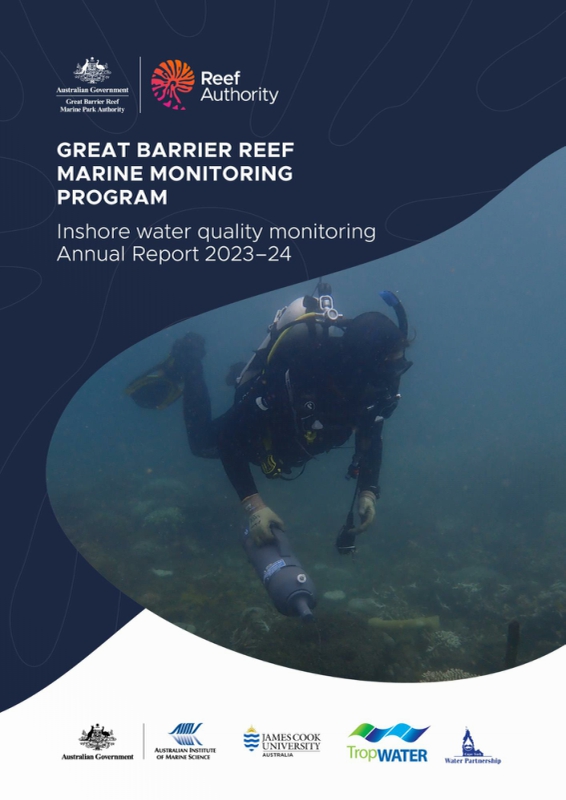
Title page 1
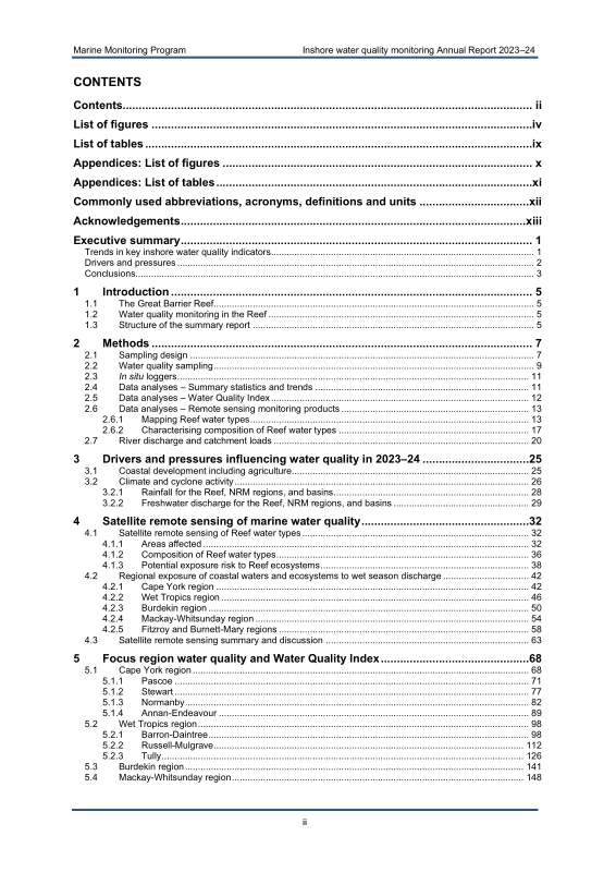
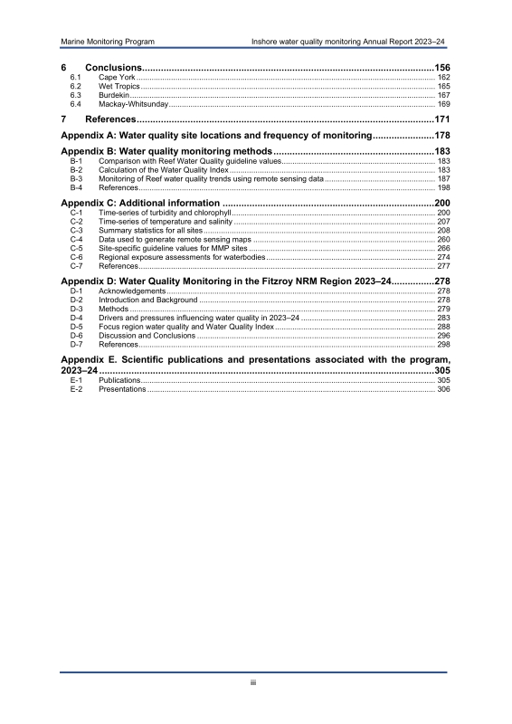
Contents 3
COMMONLY USED ABBREVIATIONS, ACRONYMS, DEFINITIONS AND UNITS 13
ACKNOWLEDGEMENTS 14
EXECUTIVE SUMMARY 15
Trends in key inshore water quality indicators 15
Drivers and pressures 16
Conclusions 17
1. INTRODUCTION 19
1.1. The Great Barrier Reef 19
1.2. Water quality monitoring in the Reef 19
1.3. Structure of the summary report 19
2. METHODS 21
2.1. Sampling design 21
2.2. Water quality sampling 23
2.3. In situ loggers 25
2.4. Data analyses - Summary statistics and trends 25
2.5. Data analyses - Water Quality Index 26
2.6. Data analyses - Remote sensing monitoring products 27
2.6.1. Mapping Reef water types 27
2.6.2. Characterising composition of Reef water types 31
2.7. River discharge and catchment loads 34
3. DRIVERS AND PRESSURES INFLUENCING WATER QUALITY IN 2023-24 39
3.1. Coastal development including agriculture 39
3.2. Climate and cyclone activity 40
3.2.1. Rainfall for the Reef, NRM regions, and basins 42
3.2.2. Freshwater discharge for the Reef, NRM regions, and basins 43
4. SATELLITE REMOTE SENSING OF MARINE WATER QUALITY 46
4.1. Satellite remote sensing of Reef water types 46
4.1.1. Areas affected 46
4.1.2. Composition of Reef water types 50
4.1.3. Potential exposure risk to Reef ecosystems 52
4.2. Regional exposure of coastal waters and ecosystems to wet season discharge 56
4.2.1. Cape York region 56
4.2.2. Wet Tropics region 60
4.2.3. Burdekin region 64
4.2.4. Mackay-Whitsunday region 68
4.2.5. Fitzroy and Burnett-Mary regions 72
4.3. Satellite remote sensing summary and discussion 77
5. FOCUS REGION WATER QUALITY AND WATER QUALITY INDEX 82
5.1. Cape York region 82
5.1.1. Pascoe 85
5.1.2. Stewart 91
5.1.3. Normanby 96
5.1.4. Annan-Endeavour 103
5.2. Wet Tropics region 112
5.2.1. Barron-Daintree 112
5.2.2. Russell-Mulgrave 126
5.2.3. Tully 140
5.3. Burdekin region 155
5.4. Mackay-Whitsunday region 162
6. CONCLUSIONS 170
6.1. Cape York 176
6.2. Wet Tropics 179
6.3. Burdekin 181
6.4. Mackay-Whitsunday 183
7. REFERENCES 185
APPENDIX A: WATER QUALITY SITE LOCATIONS AND FREQUENCY OF MONITORING 192
APPENDIX B: WATER QUALITY MONITORING METHODS 197
B-1. Comparison with Reef Water Quality guideline values 197
B-2. Calculation of the Water Quality Index 197
B-3. Monitoring of Reef water quality trends using remote sensing data 201
B-4. References 212
APPENDIX C: ADDITIONAL INFORMATION 214
C-1. Time-series of turbidity and chlorophyll 214
C-2. Time-series of temperature and salinity 221
C-3. Summary statistics for all sites 222
C-4. Data used to generate remote sensing maps 274
C-5. Site-specific guideline values for MMP sites 280
C-6. Regional exposure assessments for waterbodies 288
C-7. References 291
APPENDIX D: WATER QUALITY MONITORING IN THE FITZROY NRM REGION 2023-24 292
D-1. Acknowledgements 292
D-2. Introduction and Background 292
D-3. Methods 293
D-4. Drivers and pressures influencing water quality in 2023-24 297
D-5. Focus region water quality and Water Quality Index 302
D-6. Discussion and Conclusions 310
D-7. References 312
APPENDIX E: SCIENTIFIC PUBLICATIONS AND PRESENTATIONS ASSOCIATED WITH THE PROGRAM, 2023-24 319
E-1. Publications 319
E-2. Presentations 320
Tables 10
Table 2-1. List of parameters measured during ambient and event-based water quality monitoring 23
Table 2-2. Description of the Sentinel-3 Reef water types (WT) and corresponding Forel-Ule (FU) colour classes 29
Table 2-3. The 35 basins of the Reef catchment, the gauges for each Basin, and the correction factors used to upscale flows to provide annual discharge estimates 35
Table 3-1. Annual water year discharge (ML) of the 35 main Reef basins 45
Table 4-1. Areas (km²) and percentages (%) of the Reef, Reef-wide coral reefs, and Reef-wide surveyed seagrass affected by different risk categories of exposure... 53
Table 4-2. Areas (km²) and percentages (%) of the Cape York region, Cape York coral reefs, and Cape York surveyed seagrass affected by different categories... 59
Table 4-3. Areas (km²) and percentages (%) of the Wet Tropics region, Wet Tropics coral reefs, and Wet Tropics surveyed seagrass affected by different risk categories... 63
Table 4-4. Areas (km²) and percentages (%) of the Burdekin region, Burdekin coral reefs, and Burdekin surveyed seagrass affected by different risk categories... 67
Table 4-5. Areas (km²) and percentages (%) of the Mackay-Whitsunday region, Mackay-Whitsunday coral reefs, and Mackay-Whitsunday surveyed seagrass... 70
Table 4-6. Areas (km²) and percentages (%) of the Fitzroy region, Fitzroy coral reefs, and Fitzroy surveyed seagrass affected by different risk categories... 74
Table 4-7. Areas (km²) and percentages (%) of the Burnett-Mary region, Burnett-Mary coral reefs, and Burnett-Mary surveyed seagrass affected by different risk... 76
Table 5-1. Median wet season turbidity and chlorophyll concentrations from a Wetlabs FLNTU datalogger at Dawson Reef 108
Table 5-2. Median wet season turbidity and chlorophyll concentrations from a Wetlabs FLNTU datalogger at Forrester Reef 109
Table 6-1. Summary of results for some of the primary indicators measured in the MMP Inshore Water Quality program, 2023-24 172
Table 6-2. Water quality indicator summary for Cape York 177
Table 6-3. Water quality indicator summary for the three focus regions of the Wet Tropics 179
Table 6-4. Water quality indicator summary for the Burdekin region 181
Table 6-5. Water quality indicator summary for Mackay-Whitsunday 183
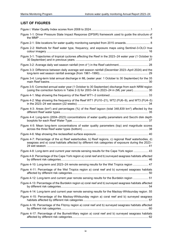
Figures 5
Figure i. Water Quality Index scores from 2008 to 2024 15
Figure 1-1. Driver Pressure State Impact Response (DPSIR) framework used to guide the structure of the MMP 20
Figure 2-1. Site locations for water quality monitoring sampled from 2015 onwards 22
Figure 2-2. Methods for Reef water type, frequency, and exposure maps using Sentinel-3-OLCI true colour imagery 30
Figure 3-1. Trajectories of tropical cyclones affecting the Reef in the 2023-24 water year (1 October to 30 September) and in previous years 41
Figure 3-2. Average daily wet season rainfall (mm d-¹) in the Reef catchment 42
Figure 3-3. Difference between daily average wet season rainfall (December 2023-April 2024) and the long-term wet season rainfall average (from 1961-1990) 43
Figure 3-4. Long-term total annual discharge in ML (water year: 1 October to 30 September) for the 35 main Reef basins 44
Figure 3-5. Corrected annual water year (1 October to 30 September) discharge from each NRM region (using the correction factors in Table 2-3) for 2003-04... 44
Figure 4-1. Map showing the frequency of the Reef WT1-2 combined 47
Figure 4-2. Map showing the frequency of the Reef WT1 (FU10-21), WT2 (FU6-9), and WT3 (FU4-5) in the 2023-24 wet season (22 weeks) 48
Figure 4-3. Areas (km²) and percentages (%) of the Reef lagoon (total 348,839 km²) affected by the different Reef water types 49
Figure 4-4. Long-term (2004-2023) concentrations of water quality parameters and Secchi disk depth boxplots for each Reef Water Type 51
Figure 4-5. Mean long-term concentrations of water quality parameters (top) and magnitude scores across the three Reef water types (bottom) 52
Figure 4-6. Map showing the reclassified surface exposure 54
Figure 4-7. Percentage of the a) Reef waterbodies, b) Reef regions, c) regional Reef waterbodies, d) seagrass and e) coral habitats affected by different risk categories... 55
Figure 4-8. Long-term and current year remote sensing results for the Cape York region 57
Figure 4-9. Percentage of the Cape York region a) coral reef and b) surveyed seagrass habitats affected by different risk categories 60
Figure 4-10. Long-term and 2023-24 remote sensing results for the Wet Tropics region 61
Figure 4-11. Percentage of the Wet Tropics region a) coral reef and b) surveyed seagrass habitats affected by different risk categories 64
Figure 4-12. Long-term and current year remote sensing results for the Burdekin region 65
Figure 4-13. Percentage of the Burdekin region a) coral reef and b) surveyed seagrass habitats affected by different risk categories 68
Figure 4-14 Long-term and current year remote sensing results for the Mackay-Whitsunday region 69
Figure 4-15. Percentage of the Mackay-Whitsunday region a) coral reef and b) surveyed seagrass habitats affected by different risk categories 71
Figure 4-16. Percentage of the Fitzroy region a) coral reef and b) surveyed seagrass habitats affected by different risk categories 74
Figure 4-17. Percentage of the Burnett-Mary region a) coral reef and b) surveyed seagrass habitats affected by different risk categories 76
Figure 4-18. Areas (km²) and percentages (%) of the Reef and Reef regions, coral reefs, and surveyed seagrass affected by different risk categories of exposure... 81
Figure 5-1. Water quality sampling sites in the Cape York region shown with water body boundaries 83
Figure 5-2. Combined Sentinel satellite images showing the extent of flood plumes and maximum turbidity (FU units) observed over the week of 18-24 December 2023,... 84
Figure 5-3. Water quality sampling sites in the Pascoe River transect with water body boundaries 85
Figure 5-4. Daily discharge and sampling dates for the Pascoe River (gauge 102102A) for the 2023-24 water year 86
Figure 5-5. Long-term discharge for the Olive and Pascoe Rivers 86
Figure 5-6. Modelled loads of (A) TSS, DIN, and PN and (B) discharge for the Pascoe catchment (note Pascoe catchment only, does not include the Olive catchment)... 87
Figure 5-7. Water quality parameters (surface and subsurface samples) and Secchi depth over distance (km) from the river mouth for the Pascoe River focus region 88
Figure 5-8. The annual condition WQ Index for the Pascoe focus region for 2023-24 89
Figure 5-9. Sentinel satellite images showing average magnitude Pascoe River flood event and sampling locations on 25 January 2024 90
Figure 5-10. Water quality sampling sites in the Stewart River transect with water body boundaries 91
Figure 5-11. Daily discharge and sampling dates for the Stewart River (gauge 104001A) for the 2023-24 wet season 92
Figure 5-12. Long-term discharge for the Stewart River (gauge 104001A - Telegraph Road) 92
Figure 5-13. Loads of (A) TSS, DIN and PN, and (B) discharge for the Stewart Basin from 2006 to 2024 93
Figure 5-14. Water quality parameters (all surface and subsurface samples for the 2023-24 season) and Secchi depth over distance (km) from river mouth... 94
Figure 5-15. Annual condition version of the WQ Index for the Stewart focus region 95
Figure 5-16. Water quality sampling sites in the Normanby Basin focus region with water body boundaries 96
Figure 5-17. Daily discharge and sampling dates for the Normanby River (gauge 105107A) for the 2023-24 wet season 97
Figure 5-18. Long-term discharge for the Normanby River (gauge 105107A - Kalpower Crossing) 97
Figure 5-19. Modelled loads of (A) total suspended solids, dissolved inorganic (DIN) and particulate nitrogen (PN) and (B) discharge for the Normanby Basin 98
Figure 5-20. Water quality parameters (surface and subsurface) and Secchi depth over distance (km) from river mouth for the Normanby focus region 99
Figure 5-21. Annual condition version of the WQ Index for the Normanby focus region 100
Figure 5-22. Water quality data under the influence of flood plumes from the Normanby and Kennedy rivers on 31 December 2023 and 26 March 2024 101
Figure 5-23. Satellite true colour image of Kennedy and Normanby River flood plume and sample locations on 31 December 2023 (left) 102
Figure 5-24. Satellite true colour image of Kennedy and Normanby River flood plume and sample locations on 26 March 2024 (left). The corresponding processed... 103
Figure 5-25. Water quality sampling sites in the Annan-Endeavour region shown with water body boundaries 104
Figure 5-26. Loads of (A) total suspended solids, dissolved inorganic (DIN) and particulate nitrogen (PN) and (B) discharge for the Endeavour Basin from 2006 to 2024 105
Figure 5-27. Daily discharge and sampling dates for the Endeavour Basin 106
Figure 5-28. Long-term discharge for the Endeavour Basin 106
Figure 5-29. Water quality parameters (surface and subsurface samples) and Secchi depth over distance from river mouth (km) for the Endeavour Basin focus region... 107
Figure 5-30. Annual condition version of the WQ Index for the Annan-Endeavour focus region 108
Figure 5-31. Satellite true colour image of flood plumes associated with Annan and Endeavour rivers and Tropical Cyclone Jasper 110
Figure 5-32. Flood event water quality data from the Annan-Endeavour transect on 20 December 2023 (blue circles) and 24 March 2024 (red circles) 111
Figure 5-33. Sampling sites in the Barron-Daintree focus region shown with water body boundaries 112
Figure 5-34. Combined discharge from rivers in the Barron-Daintree region 113
Figure 5-35. Loads of (A) TSS, DIN and PN and (B) discharge for the Barron, Daintree, and Mossman Basins from 2006-2024 114
Figure 5-36. eReefs hydrodynamic model showing coastal hydrodynamics and drivers for the Wet Tropics region on 9 December 2023 115
Figure 5-37. eReefs hydrodynamic model showing coastal hydrodynamics and drivers for the Wet Tropics region on 13 December 2023 115
Figure 5-38. eReefs hydrodynamic model showing coastal hydrodynamics and drivers for the Wet Tropics region on 15 December 2023 116
Figure 5-39. eReefs hydrodynamic model showing coastal hydrodynamics and drivers for the Wet Tropics region on 23 December 2023 116
Figure 5-40. Temporal trends in water quality variables for the Barron-Daintree focus region 119
Figure 5-41. The Water Quality Index (WQ Index) for the Barron-Daintree focus region 120
Figure 5-42. Barron River at Myola flow gauge for the 2023-24 wet season 121
Figure 5-43. Satellite true colour image on 28 December 2023 (left panel) showing the flood plume sampling sites from the Barron River 122
Figure 5-44. True colour satellite images of the Barron flood plume from 24 December 2023 (left panel) and from 28 December 2023 (right panel) 123
Figure 5-45. Water quality data from the Cairns Transect region under the influence of flood plumes from the Barron River on 19 and 28 December 2023 including... 124
Figure 5-46. Water quality data from the Cairns Transect region under the influence of flood plumes from the Barron River on 19 and 28 December 2023 including... 125
Figure 5-47. Water quality data from the Cairns Transect region under the influence of flood plumes on 28 December 2023 including the herbicides diuron... 126
Figure 5-48. Sampling sites in the Russell-Mulgrave focus region, shown with the water body boundaries 127
Figure 5-49. Combined discharge for rivers in the Russell-Mulgrave region 128
Figure 5-50. Loads of (A) TSS, DIN and PN and (B) discharge for the Russell, Mulgrave and Johnstone Basins from 2006 to 2024 129
Figure 5-51. Water quality variables measured during ambient wet and dry season sampling in 2023-24 along the Russell-Mulgrave focus region transect 130
Figure 5-52. Temporal trends in water quality variables for the Russell-Mulgrave focus region 133
Figure 5-53. The Water Quality Index (WQ Index) for the Russell-Mulgrave focus region 134
Figure 5-54. Russell-Mulgrave River (Mulgrave River at Peets Bridge + Russell River at Bucklands flow gauges) for the 2023-24 wet season 135
Figure 5-55. Satellite true colour image on 19 December 2023 (left panel) from the Wet Tropics NRM region 136
Figure 5-56. Map of the offshore Russell-Mulgrave standard event sampling sites (left); and plots of the water column profiles (right) 136
Figure 5-57. Water quality data from the Russell-Mulgrave region under the influence of flood plumes on 19 December 2023 including A) total suspended solids (TSS),... 138
Figure 5-58. Water quality data from the Russell-Mulgrave region under the influence of flood plumes on 19 December 2023 including A) dissolved inorganic phosphorus (DIP),... 139
Figure 5-59. Water quality data from the Russell-Mulgrave region under the influence of flood plumes on 19 December 2023 including the herbicides A) diuron... 140
Figure 5-60. Sampling sites in the Tully focus region, shown with the water body boundaries 141
Figure 5-61. Combined discharge from rivers in the Tully region 142
Figure 5-62. Loads of (A) TSS, DIN and PN and (B) discharge for the Tully, Murray, and Herbert Basins from 2006 to 2024 143
Figure 5-63. Water quality variables measured during ambient and event sampling in 2023-24 along the Tully focus region transect 144
Figure 5-64. Temporal trends in water quality variables for the Tully focus region 147
Figure 5-65. The Water Quality Index (WQ Index) for the Tully focus region 148
Figure 5-66. Tully River at Euramo flow gauge for the 2023-24 wet season. The dates of event sampling by JCU are marked as orange dots 149
Figure 5-67. Satellite true colour image on 13 March 2024 (left panel) showing the flood plume sampling sites from the Tully focus region 150
Figure 5-68. Water quality data from the Tully region under the influence of flood plumes on 16 December 2023 and 21 March 2024 including A) total suspended solids... 152
Figure 5-69. Water quality data from the Tully region under the influence of flood plumes on 16 December 2023 and 21 March 2024 including A) dissolved inorganic... 153
Figure 5-70. Water quality data from the Tully region under the influence of flood plumes on 16 December 2023 and the 21 March 2024 including the herbicides... 154
Figure 5-71. Sampling sites in the Burdekin focus region, shown with the water body boundaries 155
Figure 5-72. Total discharge from rivers in the Burdekin region 156
Figure 5-73. Loads of (A) TSS, DIN and PN and (B) discharge for the Burdekin and Haughton Basins from 2006 to 2024 157
Figure 5-74. Water quality variables measured during ambient and event sampling in 2023-24 along the Burdekin focus region transect 158
Figure 5-75. Temporal trends in water quality variables for the Burdekin focus region 159
Figure 5-76. The Water Quality Index (WQ Index) for the Burdekin focus region 161
Figure 5-77. Sampling sites in the Mackay-Whitsunday focus region, shown with the water body boundaries 162
Figure 5-78. Combined discharge from rivers in the Mackay-Whitsunday region 163
Figure 5-79. Loads of (A) TSS, DIN and PN and (B) discharge for the Proserpine, O'Connell, Pioneer, and Plane Basins from 2006 to 2024 163
Figure 5-80. Water quality variables measured during ambient and event sampling in 2023-24 along the Mackay-Whitsunday focus region transect 165
Figure 5-81. Temporal trends in water quality variables for the Mackay-Whitsunday focus region 166
Figure 5-82. The Water Quality Index (WQ Index) for the Mackay-Whitsunday focus region 168
Appendix Tables 12
Table A-1. Description of the water quality sites sampled by AIMS, JCU and CYWP during 2023-24 192
Table B-1. Guidelines values for four cross-shelf water bodies, provided by the Reef Authority. Values come from the Water Quality Guidelines for the Great Barrier... 197
Table B-2. Wettest and driest years used to compute the typical wet and typical dry composite frequency maps in each NRM region 203
Table B-3. Reef-wide wet season guideline values used to calculate the exposure score for satellite exposure maps 208
Table B-4. Number of collected in situ samples used in exposure scoring by region and water type 209
Table C-1. Summary statistics for water quality parameters at individual monitoring sites from 1 October 2023 to 30 September 2024 222
Table C-2. Summary of turbidity measurements from moored loggers (site locations in Section 5 and Figure D-1 for the past three water years 272
Table C-3. Summary of water quality data collected across the Sentinel-3 Reef water types (WT) as part of the wet season event sampling of the MMP 274
Table C-4. Summary of water quality data collected in the Cape York region across the Sentinel-3 Reef water types (WT) as part of the wet season event sampling of the MMP 275
Table C-5. Summary of water quality data collected in the Wet Tropics region across the Sentinel-3 Reef water types (WT) as part of the wet season event sampling of the MMP 276
Table C-6. Summary of water quality data collected in the Burdekin region across the Sentinel-3 Reef water types (WT) as part of the wet season event sampling of the MMP 277
Table C-7. Summary of water quality data collected in the Mackay-Whitsunday region across the Sentinel-3 Reef water types (WT) as part of the wet season event sampling of the MMP 278
Table C-8. Summary of water quality data collected in the Fitzroy region across the Sentinel-3 Reef water types (WT) as part of the wet season event sampling of the MMP 279
Table C-9. Site-specific guideline values (GVs) used for comparison with water quality monitoring data 280
Table C-10. Areas (km²) (and percentages, %) of the Reef lagoon (total 348,839 km²) and division by water bodies (WB) 289
Table D-1. Description of the Fitzroy water quality sites monitored during 2023-24 294
Table D-2. Water quality indicator summary for Fitzroy region 311
Appendix Figures 11
Figure B-1. Long-term water quality (WQ) concentrations and Secchi depth boxplots for each wet season colour class 205
Figure B-2. Mean long-term (2004-2023) concentrations of water quality parameters across the three wet season water types in all focus regions 206
Figure B-3. Boundaries used for the Marine Park, each NRM region, and the coral reefs and seagrass ecosystems 211
Figure C-1. Time-series of daily means of chlorophyll fluorescence and turbidity measured by moored ECO FLNTUSB instruments 220
Figure C-2. Time-series of daily means of temperature and salinity derived from moored loggers 221
Figure C-3. Areas (in km² and represented as horizontal bars) of seagrass (left) and coral reefs (right) 288
Figure D-1. Sampling sites in the Fitzroy focus region, shown with the water body boundaries 302
Figure D-2. Loads of (A) TSS, DIN and PN and (B) discharge for the Fitzroy Basin from 2006 to 2024 303
Figure D-3. Total discharge from rivers in the Fitzroy region 304
Figure D-4. Water quality variables measured during ambient sampling in 2023-24 along the Fitzroy focus region transect 305
Figure D-5. Temporal trends in water quality variables for the Fitzroy focus region 307
Figure D-6. The Water Quality Index (WQ Index) for the Fitzroy focus region 309
*표시는 필수 입력사항입니다.
| 전화번호 |
|---|
| 기사명 | 저자명 | 페이지 | 원문 | 기사목차 |
|---|
| 번호 | 발행일자 | 권호명 | 제본정보 | 자료실 | 원문 | 신청 페이지 |
|---|
도서위치안내: / 서가번호:

우편복사 목록담기를 완료하였습니다.
*표시는 필수 입력사항입니다.
저장 되었습니다.
